|
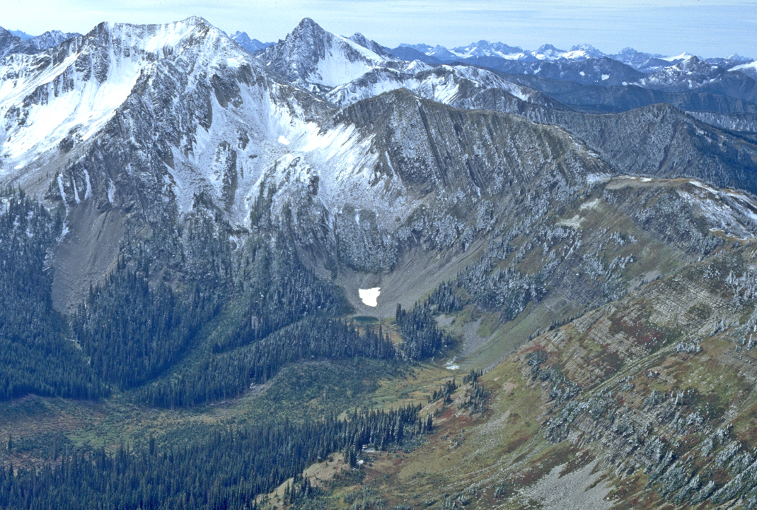
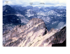
Ktf-1. View south from Mount Winthrop [RMnw] along crest of Cascade Range. Well-bedded sandstone of Cretaceous Three Fools Sequence of Haugerud and others (2002) (Ktf, rocks of Methow Ocean) form crest. Summit of Three Fools Peak is a thick conglomerate lens within the Three Fools Sequence. Divide at right was rounded by overriding Cordilleran Ice Sheet. Mixed glacial deposits (drift) from ice sheet and local alpine glaciers are visible in valley bottom (Qga). Qt, talus. This photo is figure 19 in the accompanying report (sheet 2). View image with annotation
|