
|
|
Scientific Investigations Map 2940 |
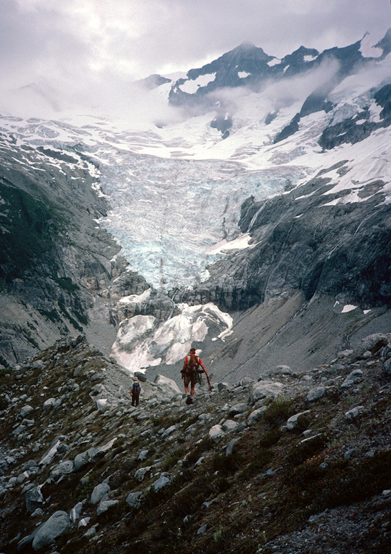
| Qag-1. View southeast along young moraine (Qag) north of Moraine Lake [MBse]. Forbidden Peak (summit at upper center of image) eroded from granodioritic orthogneiss (TKgo). Mount Torment at upper right edge of photo. Photographed in 1987. |
|
Other photos that show unit Qag:
        |