|
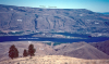
Qu-1. View northwest up Napeequa River valley from north of Little Giant Pass [Tsw]. Alluvium of valley bottom (Qa) grades into alluvium (Qu), mostly fans and valley-side debris. Napeequa Schist (Kns), with typical relict bedding, dips northeast in foreground canyon wall. The schist is intruded by Cretaceous stitching plutons: the granodiorite High Pass pluton (Kg) and tonalitic stocks (Kt) associated with the Tenpeak pluton. Qcav, rocks of young Cascade volcanoes; Qag, alpine glacial deposits (outwash and debris-flow deposits from the Clark Glacier, out of picture to left). Contacts dashed where approximately located and dotted where concealed. View image without annotation
|