
|
|
Scientific Investigations Map 2940 |
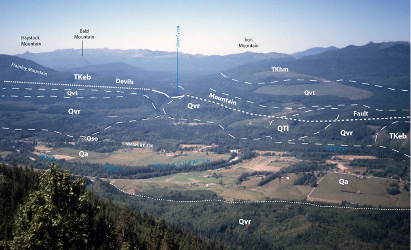
| Qvr-1. View north from Wheeler Mountain [SRsw] across North Fork Stillaguamish River valley. Terraces of Vashon recessional outwash deposits (Qvr) and alluvium of valley bottoms (Qa) are prominent. Other rocks and deposits shown, much simplified: QTl, landslide; TKhm, Helena-Haystack mélange; TKeb, eastern mélange belt; Qvt, Vashon till. Devils Mountain fault is south boundary of Darrington-Devils Mountain Fault Zone. View image without annotation |
|
Other photos that show unit Qvr:
 |