Scientific Investigations Report 2010–5246

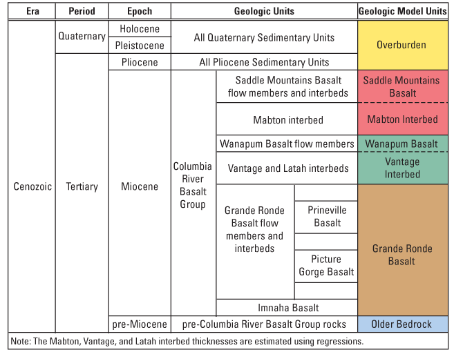
Figure 2. Relation between mapped geologic units and geologic model units as defined for the Columbia Plateau regional aquifer system, Idaho, Oregon, and Washington. The dashed line between the interbeds and the overlying basalt unit indicates that the interbed thickness may be estimated as a fraction of the total distance between the top of the overlying and underlying basalt model units. |
First posted February 25, 2011
For additional information contact: Part or all of this report is presented in Portable Document Format (PDF); the latest version of Adobe Reader or similar software is required to view it. Download the latest version of Adobe Reader, free of charge. |