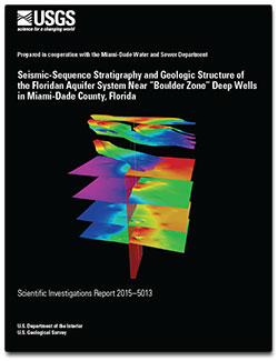
 Abstract Abstract
The U.S. Geological Survey, in cooperation with the Miami-Dade Water and Sewer Department, acquired, processed, and interpreted seismic-reflection data near the North and South District “Boulder Zone” Well Fields to determine if geologic factors may contribute to the upward migration of injected effluent into that upper part of the Floridan aquifer system designated by the U.S. Environmental Protection Agency as an underground source of drinking water. The depth of the Boulder Zone at the North and South District “Boulder Zone” Well Fields ranges from about 2,750 to 3,300 feet below land surface (ft bls), whereas overlying permeable zones used as alternative drinking water supply range in depth from about 825 to 1,580 ft bls at the North and South District “Boulder Zone” Well Fields. Seismic-sequence stratigraphy and geologic structures imaged on seismic-reflection profiles created for the study describe the part of the Floridan aquifer system overlying and within the Boulder Zone. Features of the Floridan aquifer system underlying the Boulder Zone were not studied because seismic-reflection profiles acquired near the North and South District “Boulder Zone” Well Fields lacked adequate resolution at such depths.
Stratigraphic analysis of seismic-reflection data collected from the study area was mainly applied to the Floridan aquifer system and used to identify four provisional seismic sequences, which extend vertically from near the base of the Floridan aquifer system upward to the lower part of the intermediate confining unit. These four seismic sequences compose a framework in which each sequence includes a major permeable unit of the Floridan aquifer system; from shallowest to deepest, these units are the Upper Floridan aquifer, Avon Park permeable zone, uppermost major permeable zone of the Lower Floridan aquifer, and Boulder Zone. The relations between seismic-sequence stratigraphy and hydrostratigraphy allow for detailed mapping of permeable zones and semiconfining units of the Floridan aquifer system at a level of resolution never before accomplished using well data alone.
In addition to the preceding seismic-reflection analysis, interpretation of geophysical well log data from four effluent injection wells at the North District “Boulder Zone” Well Field delineated a narrow karst collapse structure beneath the injection facility that extends upward about 900 ft from the top of the Boulder Zone to about 125 ft above the top of the uppermost major permeable zone of the Lower Floridan aquifer. No karst collapse structures were identified in the seismic-reflection profiles acquired near the North District “Boulder Zone” Well Field. However, karst collapse structures at the level of the lowermost major permeable zone of the Lower Floridan aquifer at the South District “Boulder Zone” Well Field are present at three locations, as indicated by seismic-reflection data acquired in the C–1 Canal bordering the south side of the injection facility. Results from the North District “Boulder Zone” Well Field well data indicate that a plausible hydraulic connection between faults and stratiform permeability zones may contribute to the upward transport of effluent, terminating above the base of the deepest U.S. Environmental Protection Agency designated underground source of drinking water at the North District “Boulder Zone” Well Field.
|
First posted March 20, 2015
Part or all of this report is presented in Portable Document Format (PDF). For best results viewing and printing PDF documents, it is recommended that you download the documents to your computer and open them with Adobe Reader. PDF documents opened from your browser may not display or print as intended. Download the latest version of Adobe Reader, free of charge. More information about viewing, downloading, and printing report files can be found here.
|

