Geologic Features of the Sea Bottom Around a
Municipal Sludge Dumpsite near 39řN, 73řW,
Offshore New Jersey and New York: U.S. Geological Survey Open-file
Report 94-152
ILLUSTRATION AND CAPTIONS SUMMARY
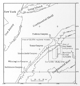
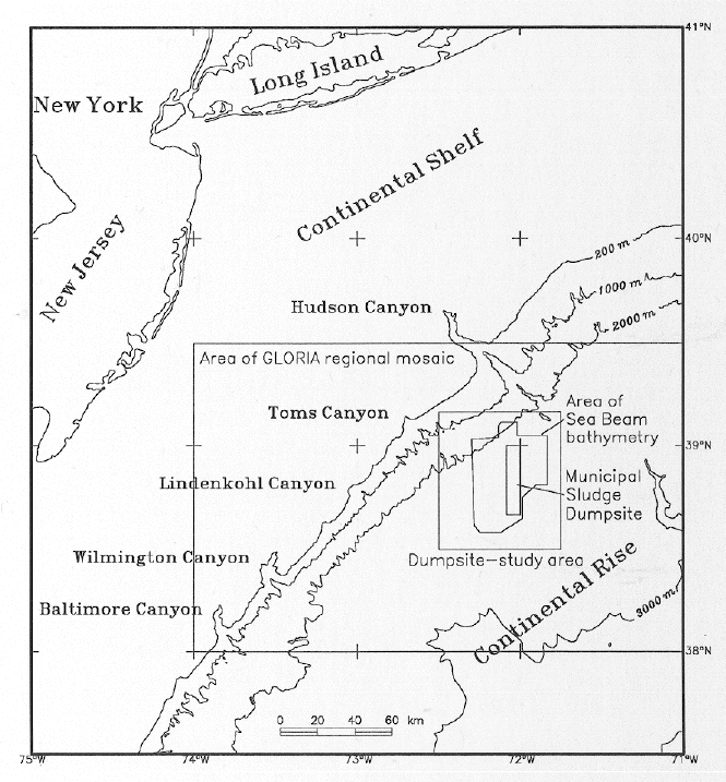
An Index Map showing the continental margin off the mid-Atlantic
Coast of the U.S. Areas of the following GLORIA mosaic illustration
and the site-mapping studies are outlined as rectangles; an area
mapped using Sea Beam bathymetry is shown as an irregular polygon; and
the most recent sludge dumpsite area is outlined as a smaller
north-south rectangle.

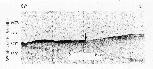
Airgun seismic-reflection profile across the central part of the
study area. Nearly flat continental-rise sediments of Neogene age lap
onto an unconformity on seaward-dipping Eocene strata of the
continental slope.
This profile shows back-tilted blocks at the base of the slope on
the rise and several truncated horizons in older, buried base-of-slope
troughs or blocks within the onlapping rise strata.

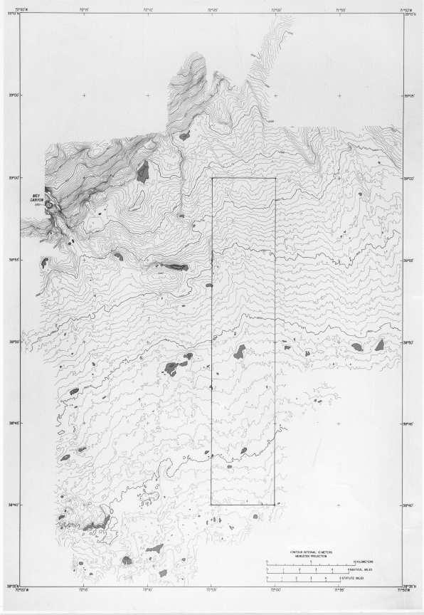
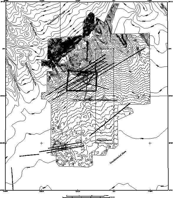
Bathymetric contours. Sea-Beam soundings gridded to 125-m
interval and contoured at sea aboard RV Atlantis II, during September,
1989. Depressions are shaded.
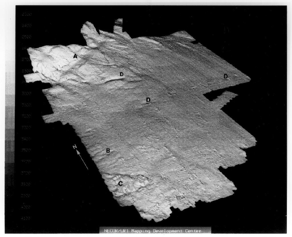
Perspective image of Sea Beam bathymetric data set. View from
southwest, looking northeast, across upper rise. Lower part of
continental slope on upper left. Brightness of each grid cell in this
image is varied with respect to a vertical sun angle and the viewer's
position. Note the terrace or trough at the base of the continental
slope (A), the slope-parallel wrinkles(?) (B), an area of probable
slide deformation on the upper rise (C), and depressions (D). Slight
north-south bands of noise show where data swaths abut. Image courtesy
of Robert C. Tyce, University of Rhode Island.
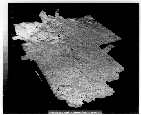
GLORIA sidescan-sonar mosaic of
slope and rise off the mid-Atlantic coast of the U.S. shows the study
area in relation to features of neighboring areas of the sea floor
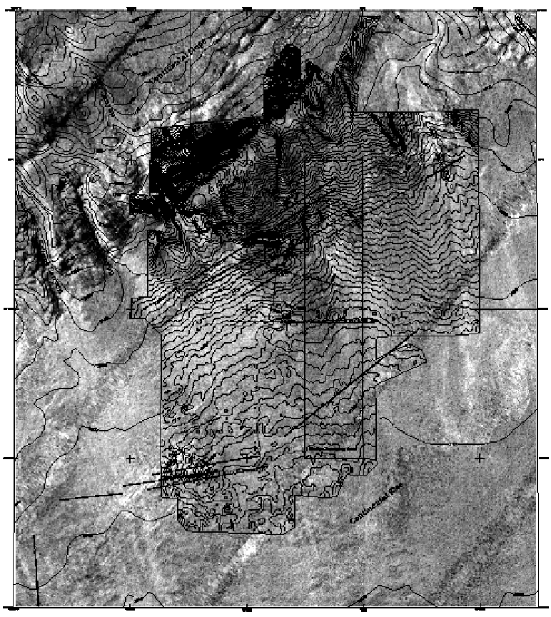
Bathymetric contours at 200, 1000, 2000, and 3000 meters. The areas
of site study, Sea Beam bathymetry, and municipal sludge dumpsite
are outlined.

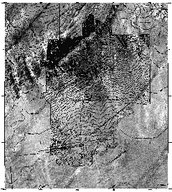

Center: Composite illustration of GLORIA imagery and bathymetric
contours of the dumpsite study area. The central part of this area was
mapped using Sea Beam data, and is shown using a 10-m contour interval;
contours of the peripheral area, at a 100-m interval, from Escowitz
and others (1988); of the northeastern part, kindly provided by
A. Shor). Note the congruence of the GLORIA backscatter pattern and
the bathymetric contours. Central dark colored deposit separates lower
areas, which finer scale imaging (below) shows to be furrowed. Left
image: GLORIA imagery of study area without overlay. Right image:
Contour lines and location of deep-towed 120-kHz sidescan-sonar
imagery. Rectangle shows location of data illustrated below.

Airgun seismic-reflection profile along upper continental rise
near base of slope shows strata of uppermost rise, slump structures,
and faults. Labeled scarp is shown in higher resolution profile
below.

High-resolution 3.5-kHz subbottom profile shows faulting and
tilting of surficial acoustically laminated strata on upper rise; graben
created by slumping of upper rise sediments. Labeled scarp is
crossed by airgun profile above.
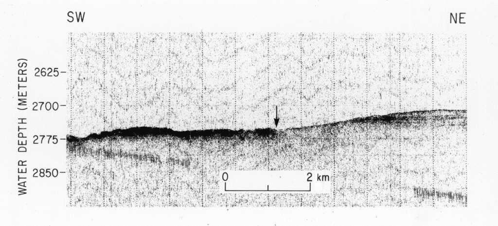
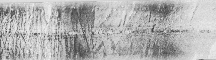
High-resolution 3.5-kHz subbottom profile across the seaward part
of study area on upper continental rise. Arrow marks transition
between area of smooth surface to the northeast, and rough,
acoustically impenetrable surface, probably of blocky debris-flow
deposits to the southwest. This 3.5-kHz profile shows deposit
overlying surface that is seen (elsewhere) to be furrowed.
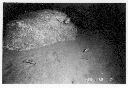

Boulders observed during dives of RV Alvin in 1989. Boulders are
about 2 m in diameter. A (left). Dive 2163, water depth about 2485 m;
B (right). Dive 2165, water depth about 2405 m.

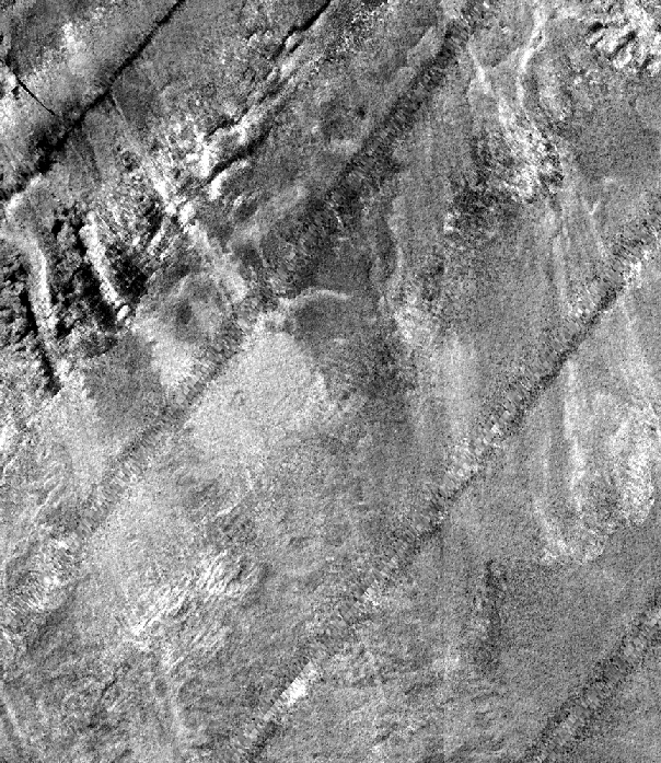
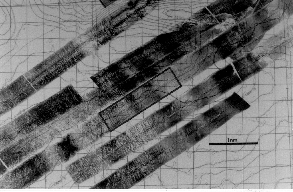
Left: 120-kHz Sidescan-sonar tracklines (vehicle tracks) in relation
to
bathymetry. Rectangle locates next image.
Center: Mosaicked images over furrowed bottom area; 10-m contour
interval.
Closed-contours show depression (upper right quadrant: 2500-m contour
identified) and the neighboring, downrise, elliptical high (near upper
center of image). Rectangle locates the swath shown in the next
image.
Right: A single swath of AMS-120 sidescan-sonar imagery, 900 m
wide x 3300 m long. See location to left.
A "visual analog" 

Note the surface features of the
Blackhawk landslide in California. Closer view on right. Photographs from Thornbury (1954). Note that the rise
features have much less relief, but may be similar to the surface features
here, apart from the vertical exaggeration.
- To return, click on "BACK", or on:
- Abstract...
- Introduction...
- Data and Methods...
- (Bathymetric map)
- (GLORIA mosaic)
- Description of the sea floor...
- Discussion...
- Conclusions...
- References Cited...
******
[an error occurred while processing this directive]