Woods Hole Field Center Home Page Coastal and Marine Geology Program Home Page U.S. Geological Survey with link to U.S.G.S. Home Page
USGS Banner
Links to Woods Hole Field Center and Coastal and Marine Geology Program
 

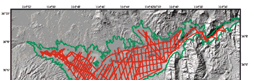
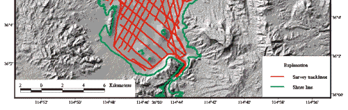
Surficial Geology and Distribution of Post-Impoundment Sediment of the Western Part of Lake Mead Based on a Sidescan Sonar and High-Resolution Seismic-Reflection Survey


Figure 3.   Tracklines in the Boulder Basin and Las Vegas Bay parts of Lake Mead along which sidescan sonar, subbottom seismic-reflection profiles, bathymetry, and navigation were collected. All four types of data were continuously collected along all of these lines.

Click on map for larger image.

Figure 3. Tracklines in the Boulder Basin and Las Vegas Bay parts of Lake Mead along which sidescan sonar, subbottom seismic-reflection profiles, bathymetry, and navigation were collected.


 Back to Top  Title Page

 Introduction  Methods  Results  Discussion  Summary  References

Web Page by Donna Newman
[an error occurred while processing this directive]