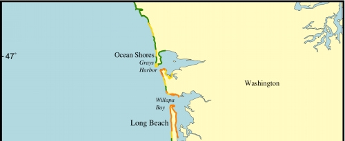
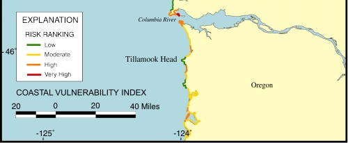
Figure 4. Map of the Coastal Vulnerability Index for the open ocean coast of southwestern Washington and northwestern Oregon.
Click on map to zoom in