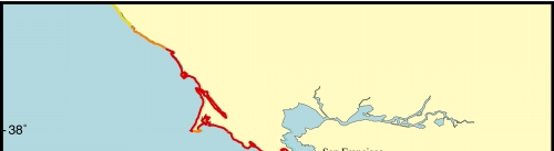
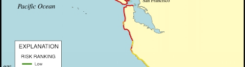
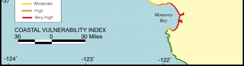
Figure 8. Map of the Coastal Vulnerability Index for the San Francisco - Monterey region.
Click on map to zoom in
U.S. Department of the Interior, U.S. Geological Survey URL: http://pubs.usgs.gov/of/2000/of00-178/pages/figpage/fig8.html Maintained by Publishing Services Last modified: 14:54:55 Thu 06 Sep 2001 Privacy statement | General disclaimer | Accessibility