|
This section describes the data collected for this project, the location of the data, and how to access them.
Data Format and Projection
The primary format for all vector data is the file geodatabase feature class in the Universal Transverse Mercator (UTM) Coordinate System, Zone 19, WGS84. For users without access to ArcGIS 9.2 or higher, all vector data are also delivered in as ESRI shapefiles in the geographic coordinate system (WGS84). The raster data are GeoTIFFs and ESRI Grids in UTM, Zone 19, WGS84 projection. The sidescan-sonar backscatter mosaics are also delivered in geographic coordinate system (WGS84) for viewing through the Coastal and Marine Geology Program Internet Map Server (http://coastalmap.marine.usgs.gov/).
All spatial data are distributed with Federal Geographic Data Committee (FGDC) compliant metadata in .xml format. The metadata for data outside the file geodatabase is also in text (*.txt) and FGDC Classic (*.html) format. The metadata for feature classes in the file geodatabase are in .xml format only, but can be viewed and exported by using ArcCatalog (ver. 9.2) in eight other formats, including FGDC Classic.
Data Access
The complete data sets from this project can be accessed in three different ways depending on the software you have available.
- If you have ArcGIS 9.2 or higher – view and manipulate all data.
- If you do not have any GIS software – view all data (free software download required).
- If you have ArcView 3.x – view all data in shapefile format and the ESRI binary bathymetry grids.
If you have ArcGIS 9.2 or higher:
Copy the following folder GIS/OFR2007_1373 or download the GIS/OFR2007_1373 WinZip file to your computer and open the ArcMap document CapeAnn_SalisburyBeach.mxd. This map document has all the data layers loaded in the table of contents and uses relative hyperlinks so there is no need to change any pathways for drive letters as long as you keep all the folders under the parent directory (GIS).
If you do not have any GIS Software:
You can still view all the data via ArcReader, a free mapping application distributed by ESRI for Windows, Linux, and Unix operating systems. You will need to download ArcReader and install it on your computer. Go to the ESRI website at http://www.esri.com/software/arcgis/arcreader/download.html and follow the directions for downloading and installing the free software. Once ArcReader is installed on your computer, you can view all the data by opening the Published Map File (pmf) at GIS/CapeAnn_SalisburyBeach.pmf.
Data Organization
The data are organized in folders of the DVD and website as described below.
 GIS – top-level directory for all spatial data. Copy or download this folder to a local hard drive. Note: the size of the uncompressed version of this directory on the DVD is 2.14 Gb, whereas the size of the compressed version is 260 Mb. The compressed version does not include the bottom photo or seismic-profile images that can be downloaded separately below. GIS – top-level directory for all spatial data. Copy or download this folder to a local hard drive. Note: the size of the uncompressed version of this directory on the DVD is 2.14 Gb, whereas the size of the compressed version is 260 Mb. The compressed version does not include the bottom photo or seismic-profile images that can be downloaded separately below.
CapeAnn_SalisburyBeach.mxd – ArcGIS 9.2 map document with all data loaded in the table of contents.
CapeAnn_SalisburyBeach.pmf – ESRI ArcReader (Publisher 9.2) map document for use with free ArcReader software. You can download ArcReader free of charge on the www at: http://www.esri.com/software/arcgis/arcreader/download.html
OFR2007_1373.gdb – ArcGIS 9.2 file geodatabase with all vector data stored in feature class format. The size of the uncompressed file geodatabase on the DVD is 36 Mb, and the size of the compressed file is 8.1 Mb. See data catalog below for more information.
Raster – Folder containing all raster data in ESRI Grid, or GeoTIFF formats.
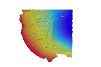
Bathymetry – Contains bathymetry and hillshade grids of nearshore, offshore, and merged data.
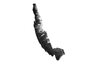
Backscatter – Contains the sidescan-sonar backscatter tiled GeoTIFF mosaics for nearshore and offshore areas.
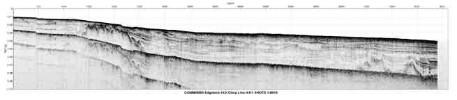
Hyperlink_images – Contains seismic profile and bottom photography images in JPEG format. Seismic profile images are hyperlinked to the SeismicTracklines layer in the ArcMap Document table of contents. Bottom photographs are hyperlinked to the BottomPhotos data layer. Use the hyperlink tool in ArcGIS to click on these data layers in the data view to view the linked image.
Layers – Contains ArcGIS layer files that store the user-defined symbology, labeling, and other display parameters of the feature class, grid, or GeoTIff.
Shapefile – Contains the eight feature classes from the geodatabase in shapefile format (geographic coordinate system WGS84).
Data Catalog
Vector Data – The vector data are stored and delivered together in a single file geodatabase. A user with ArcGIS 9.2 or higher can download the single zip file (OFR2007_1373_FGDB.zip) below and access all the vector data and associated metadata. A user without ArcGIS 9.2 or higher can access the data as individual shapefiles in geographic coordinates system. The hyperlinks in the first column below (Layer (metadata for shapefiles)) are linked to the metadata for the shapefile version of the data.
Raster Data – The primary coordinate system for the raster data is UTM Zone 19. The backscatter mosaics and merged bathymetry are also delivered in the geographic coordinate system.
Raster Layer (metadata) |
Description |
View |
Download |
bath_is5m |
5-meter bathymetric grid of the inshore survey area in ESRI 32-bit continuous floating point format. |
|
UTM 19 |
bath_os5m |
5-meter bathymetric grid of the offshore survey area in ESRI 32-bit continuous floating point format. |
|
UTM 19 |
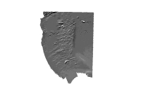
cabath5m |
5-meter bathymetric grid of both the inshore and offshore survey areas in ESRI 32-bit continuous floating point format. |
|
UTM 19 |
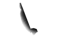
cabath5mhs |
5-meter bathymetric hillshade grid of both the inshore and offshore survey areas in ESRI 16-bit continuous unsigned integer format. |
|
UTM 19 |
| cabath5m_geog |
5-meter bathymetric hillshade grid of both the inshore and offshore survey areas in GeoTIFF format. |
 |
Geographic |
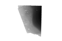
klein_bs1m |
1-meter backscatter mosaic of the inshore survey area in 8-bit continuous unsigned integer GeoTIFF format |
|
UTM 19
Geographic |
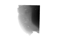
reson_bs5m |
5-meter backscatter mosaic of the inshore survey area in 8-bit continuous unsigned integer GeoTIFF format |
|
UTM 19
Geographic |
|