Skip past header information
USGS - science for a changing world

U.S. Geological Survey Open-File Report 2010-1146

Coastal Vulnerability Assessment of the Northern Gulf of Mexico to Sea-Level Rise and Coastal Change


Skip past navigation menu to main textTitle Page / Contents / List of Figures and Tables / Conversion Factors and Datum / Abstract / Introduction / Northern Gulf of Mexico / Methods / Geologic Variables / Physcial Process Variables / Results / Discussion / Conclusions / Acknowledgments / References Cited / Appendix


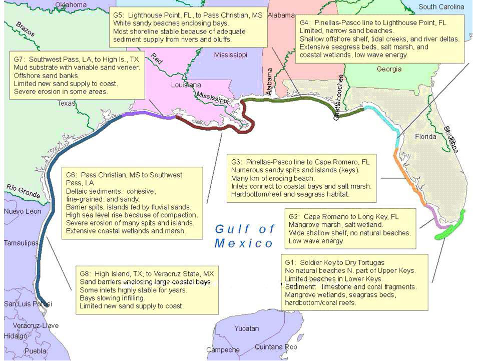
Figure 3. The eight geomorphic regions classified by A. Morang (written communication, January 11, 2010) for the Gulf of Mexico. Image courtesy of Andrew Morang, Engineer Research and Development Center, U.S. Army Corps of Engineers.

Figure 3 is a map of the eight geomorphic regions classified by A. Morang (written communication, January 11, 2010) for the Gulf of Mexico. Image courtesy of Andrew Morang, Engineer Research and Development Center, U.S. Army Corps of Engineers. These regions include sandy barriers enclosing bays, Chenier Plains, and deltaic settings.


To view files in PDF format, download a free copy of Adobe Reader.


Accessibility FOIA Privacy Policies and Notices

Take Pride in America logo USA.gov logo U.S. Department of the Interior | U.S. Geological Survey
URL: https://pubsdata.usgs.gov/pubs/of/2010/1146/html/imagepages/Figure3.html
Page Contact Information: Contact USGS
Page Last Modified: Wednesday, 07-Dec-2016 22:36:52 EST