U.S. Geological Survey Open-File Report 2011–1005
Surficial Geology of the Sea Floor in Central Rhode Island Sound Southeast of Point Judith, Rhode Island
![]() Title |
List of Figures |
Conversion Factors |
Abstract |
Introduction |
Setting |
Methods |
Bathymetry |
Sediments |
Bottom Photography |
GIS Data Catalog |
Summary |
Acknowledgments |
References |
Contacts
Title |
List of Figures |
Conversion Factors |
Abstract |
Introduction |
Setting |
Methods |
Bathymetry |
Sediments |
Bottom Photography |
GIS Data Catalog |
Summary |
Acknowledgments |
References |
Contacts
 |
||
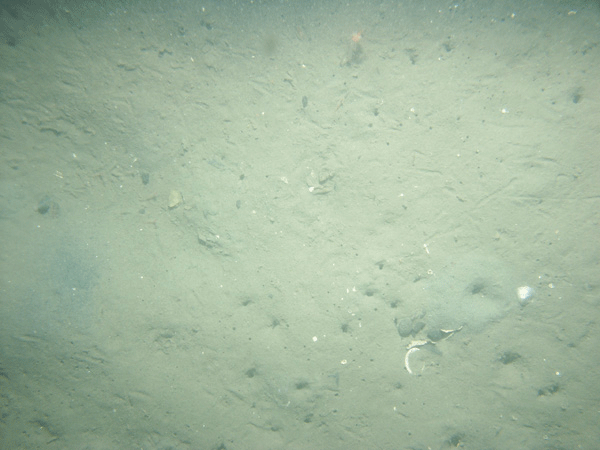
Figure 19. Photograph of a typical sandy sea floor at station 996-7, located in the north-central part of the study area, showing burrows, scattered shells, and animal tracks. Location of photograph shown in figure 18. |
||


