
|
| Click on figures for larger images. |
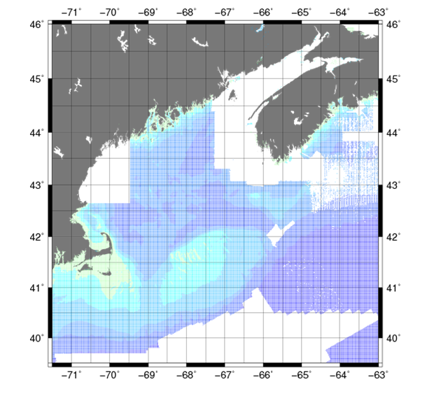 |
Figure 6. A map showing the extent of the Smith and Sandwell Global Topography data. |
Data from the Smith and Sandwell Global Topography
(Smith and Sandwell, 1977) are a combination of shipboard depth soundings and
estimated depths based on gravity measurements to produce a gridded representation of seafloor
topography for all ice-free ocean areas within ±72° W latitude. The depth data were obtained by
screening 6,905 surveys from the NGDC (Marine Trackline Geophysics CD-ROM version 3.2), the Scripps
Institution of Oceanography and Lamont-Doherty Earth Observatory databanks, and other data, using
quality control procedures based on (Smith and Sandwell, 1997).
Data Properties:
- Vertical Datum: MSL
- Vertical Accuracy: Unknown
- Coordinate System: Geographic Decimal Degrees
- Horizontal Datum: WGS84
- Horizontal Accuracy: Unknown
- Resolution: 1 arcminute
- Year Data Published: 2009
- Format: ASCII XYZ
- Date Data Downloaded: July 2011, Version 12.1
Data were downloaded from the University of
California San Diego Global Topography Website
for the region of 71°30' to 63° W and 39°30' to 46° N. The data retained after buffering and manual removal to avoid conflicting with higher quality data are shown in figure 6.
For more information on the buffering and manual removal, see Common Processing Steps and Data.
The vertical datum was adjusted to NAVD88 using the method described in Common Processing Steps and Data.
|


