Great Plains Desertification
| Goal: Improve the land and water use decisions made by the public and private sector. |
| The USGS role is to provide integrated earth science information about land and water use in support of management and other policy decisions, develop analytical tools for improved decisionmaking, and enhance the understanding of how natural processes at the Earth's surface are affected by changes in climate or land and water use. |
The USGS and the Bureau of Reclamation developed a joint work plan for the San Juan River basin; the plan identified the technical issues to be incorporated in the computer models of the watershed. The major issues addressed are competition for water, Indian water rights, and flow regulation and habitat change. Products include a Modular Modeling System -- a framework for organizing models of the natural environment and models for managing natural resources -- which is completed and will be implemented within the operating systems of the Bureau of Reclamation and other agencies responsible for aspects of management of these river basins.
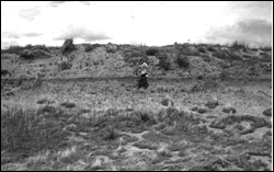
| Windblown sand deposits with sparse vegetation surround primary croplands in the central United States. These deposits are vulnerable to extensive movement during periods of prolonged drought. USGS research is designed to find out when these sands were active in the past and to anticipate the conditions under which they could reactivate in the future, encroaching on lands that are now in productive agriculture. USGS research on desertification in the Great Plains has attracted the attention of the "New York Times," ABC News, the Public Broadcasting System, and the Smithsonian Institution for news articles and stories. Thereby informing a larger audience of potential impacts of climate change. (See fig. 5.) |
Great Plains Desertification |
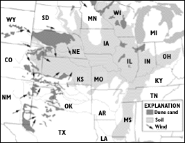
Figure 5. Location and potential movement of dune sand onto agricultural lands. This map shows the distribution of presently inactive sand dunes in the Great Plains region. |
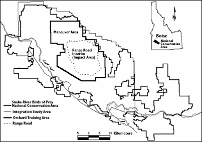
A spatially explicit computer simulation of ecosystem dynamics for habitat, raptors, and prey in the Snake River Birds of Prey National Conservation Area and the Naursum Reserve in northern Kazakstan was developed by USGS scientists. The incorporation of baseline vegetation maps into the simulation allows projection of future conditions in relation to land use and climate change. Information on long-term responses to disturbance allows land managers to anticipate changes in prey and raptors and initiate management practices that sustain the productivity and biodiversity of ecosystems.
| USGS scientists worked cooperatively with other Federal and State agencies to increase the amount of suitable habitat for sport fishes in the Upper Mississippi River during winter. Scientists determined that introducing low flows into backwater lakes increased oxygen levels and maintained tolerable temperatures for sport fishes during this critical period. During summer, flow rates can be increased to reduce sedimentation in backwaters and to oxygenate deep areas, thus providing more habitat for fish and for their invertebrate food sources. These study results will be used to develop cost-effective designs for flow-introduction projects in other backwater areas. |
|
Water Availability and Quality || Natural Hazards || Geographic and Cartographic Information || Contaminated Environments || Land and Water Use || Nonrenewable Resources || Environmental Effects on Human Health || Biological Resources Return to Business Activities