Information For Advanced Users
Although this application provides a number of useful and sophisticated
geoprocessing and cartographic functions, some users might find the need
for more advanced Geographic Information System (GIS) analysis. Some of this functionality may
include sophisticated queries and advanced cartographic functions
including labeling and annotation. Given the interoperable nature of this
product, these data can be used in a variety of applications. The
following options are available:
-
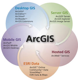 Using ArcGIS Desktop—The services implemented in the
Oil and Gas Exploration and Production Interactive Map Service application and interface can be easily
integrated into your existing data in a 9.x version of ArcGIS Desktop. Add
an internet server by using the "Add Internet Server" dialogue in
ArcCatalog. The internet host name will be
http://certmapper.cr.usgs.gov. Once the internet server has been
successfully added, select the map service name, "US_Production." This
service can be used in either ArcCatalog or ArcMap. For more details
related to ArcGIS Desktop products, visit the ESRI ArcGIS product overview
homepage at http://www.esri.com/software/arcgis/.
Using ArcGIS Desktop—The services implemented in the
Oil and Gas Exploration and Production Interactive Map Service application and interface can be easily
integrated into your existing data in a 9.x version of ArcGIS Desktop. Add
an internet server by using the "Add Internet Server" dialogue in
ArcCatalog. The internet host name will be
http://certmapper.cr.usgs.gov. Once the internet server has been
successfully added, select the map service name, "US_Production." This
service can be used in either ArcCatalog or ArcMap. For more details
related to ArcGIS Desktop products, visit the ESRI ArcGIS product overview
homepage at http://www.esri.com/software/arcgis/.
-
Using ArcExplorer—This map service can also be
integrated with existing data using a free GIS software viewer called
ArcExplorer. For additional information regarding ArcExplorer and to
download this free application, visit the ArcExplorer homepage at http://www.esri.com/software/arcexplorer/.
-
Using ArcGIS Explorer—ArcGIS Explorer is a lightweight client for ArcGIS Server. It can be used to access, integrate, and utilize GIS services, geographic content, and other Web services. For more information about ArcGIS Explorer, visit http://www.esri.com/software/arcgis/explorer/.
-
Using ArcWeb Services —ArcWeb Services offer developers a rich set of Web services application programming interfaces (APIs) for integrating mapping functionality and GIS content into browser, desktop, mobile, and server applications to help solve many different types of problems. Visit the following ESRI website, http://www.esri.com/software/arcwebservices/, to download and for more information about this free application.
