
Abstract
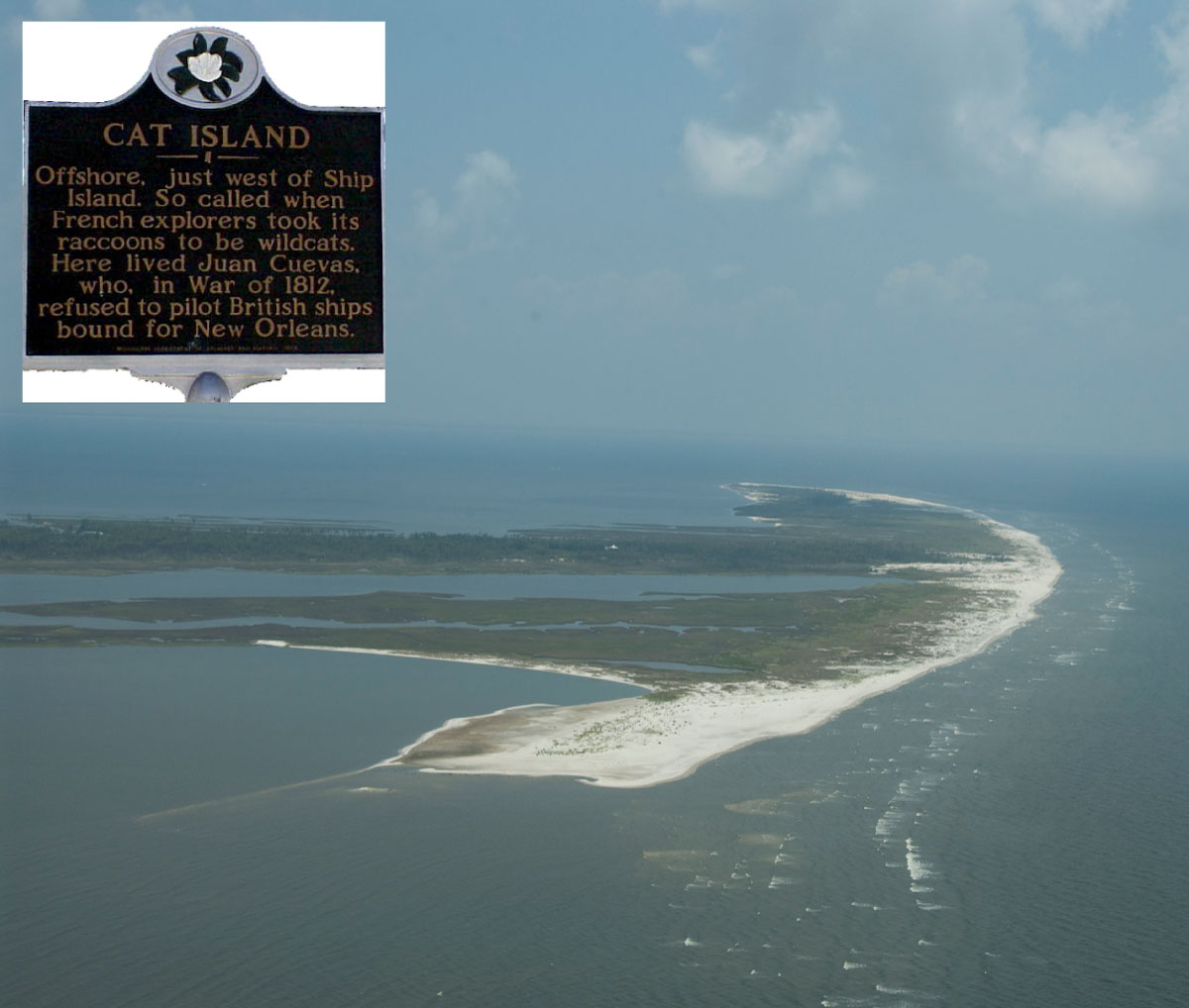
Cat Island, Mississippi, looking north (aerial photo courtesy of Karen Morgan, USGS). [Click to enlarge]
Scientists from the U.S. Geological Survey, St. Petersburg Coastal and Marine Science Center, in collaboration with the U.S. Army Corps of Engineers, conducted geophysical and sedimentological surveys in 2010 around Cat Island, Mississippi, which is the westernmost island in the Mississippi-Alabama barrier island chain. The objective of the study was to understand the geologic evolution of Cat Island relative to other barrier islands in the northern Gulf of Mexico by identifying relationships between the geologic history, present day morphology, and sediment distribution.
This data series serves as an archive of terrestrial and marine sediment vibracores collected August 4-6 and October 20-22, 2010, respectively. Geographic information system data products include marine and terrestrial core locations and 2007 shoreline data. Additional files include marine and terrestrial core description logs, core photos, results of sediment grain-size analyses, optically stimulated luminescence dating and carbon-14 dating locations and results, Field Activity Collection System logs, and formal Federal Geographic Data Committee metadata (Data Products and Downloads).
acknowledgments
We thank our cooperator U.S. Army Corps of Engineers for the opportunity to work with them and continue our geologic assessment of the Mississippi-Alabama barrier island chain. We especially thank Dawn Lavoie for helping develop and organize this project. We also appreciate help with grain-size data: Carl Taylor; web design, Jolene Gittens; and field assistance, James Flocks, Chandra Dreher, Rich Young (U.S. Geological Survey), Dallon Weathers, Mike Brown, Kathryn Rose (University of New Orleans), Michael Potts (National Park Service), and Meghan Alesce (intern for the U.S. Army Corps of Engineers). We thank the reviewers of this document, Julie Bernier and Chris Reich, for their helpful and constructive comments.
Information Statement
This online and DVD publication was prepared by an agency of the United States Government. Although these data have been processed successfully on a computer system at the U.S. Geological Survey, no warranty expressed or implied is made regarding the display or utility of the data on any other system, or for general or scientific purposes, nor shall the act of distribution imply any such warranty. The U.S. Geological Survey shall not be held liable for improper or incorrect use of the data described and (or) contained herein. Reference herein to any specific commercial product, process, or service by trade name, trademark, manufacturer, or otherwise does not constitute or imply its endorsement, recommendation, or favoring by the United States Government or any agency thereof.
Suggested Citation
Buster, N.A., Kelso, K.W., Miselis, J.L, and Kindinger, J.L., 2014, Sediment data collected in 2010 from Cat Island, Mississippi: U.S. Geological Survey Data Series 834, https://dx.doi.org/10.3133/ds834.
ISSN 2327-638X (online)
Contact
Noreen A. Buster
Geologist
U.S. Geological Survey
St. Petersburg Coastal and Marine Science Center
600 4th Street South
St. Petersburg, FL 33701
(727) 502-8114
nbuster@usgs.gov
