
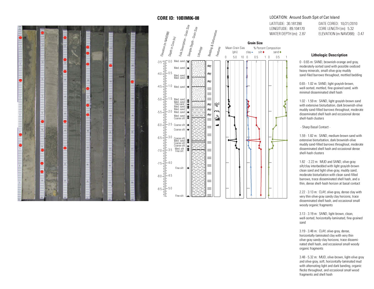
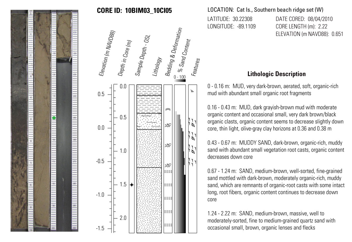
Core descriptions, grain size, and photos
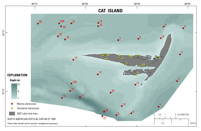
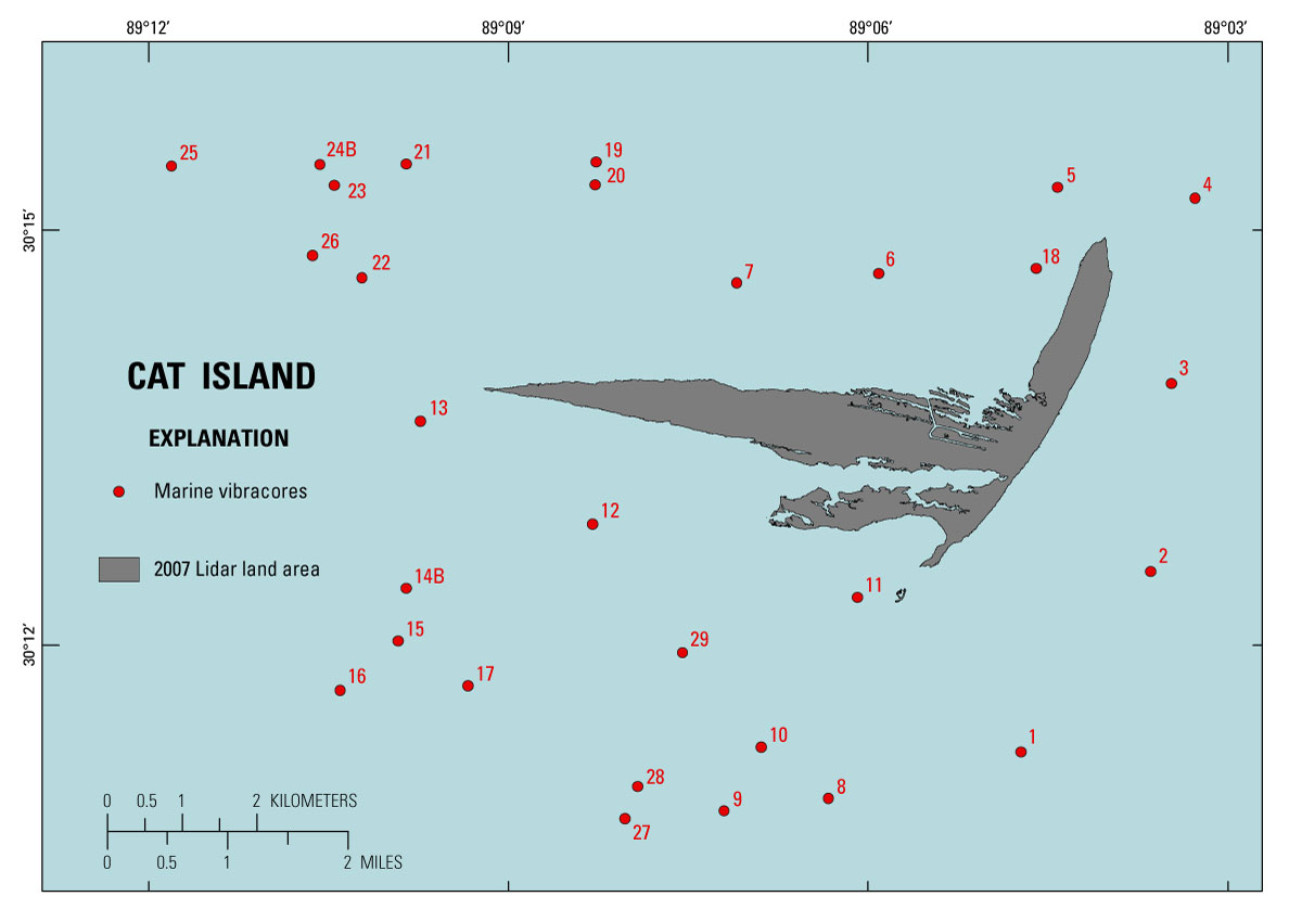
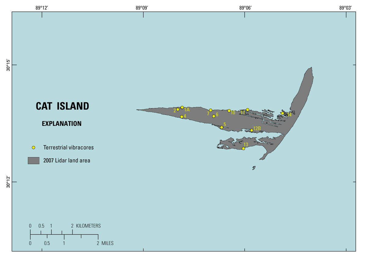
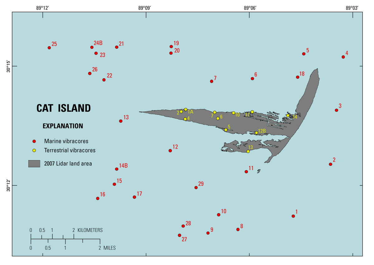
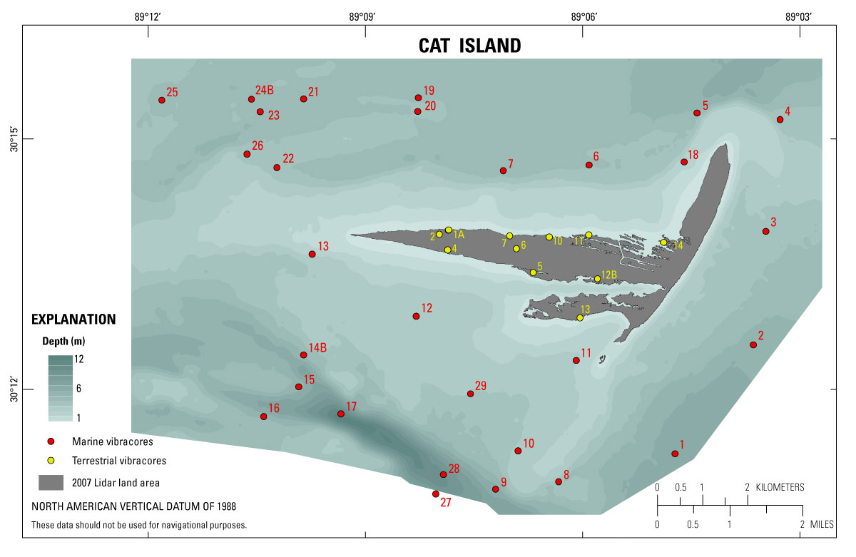
Figure 7. Locations of marine and terrestrial vibracores collected around Cat Island, Mississippi in 2010. The background is a 50-meter grid of 2010 bathymetry surrounding Cat Island, Mississippi (Buster and others, 2012), with 2007 shoreline derived from lidar topography (modified from Smith and others, 2009). Click on core location for PDF file with core description, grain size, and photo. m, meter. [Click to enlarge]
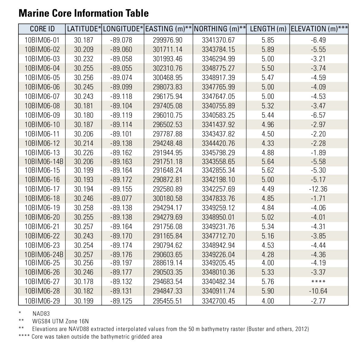
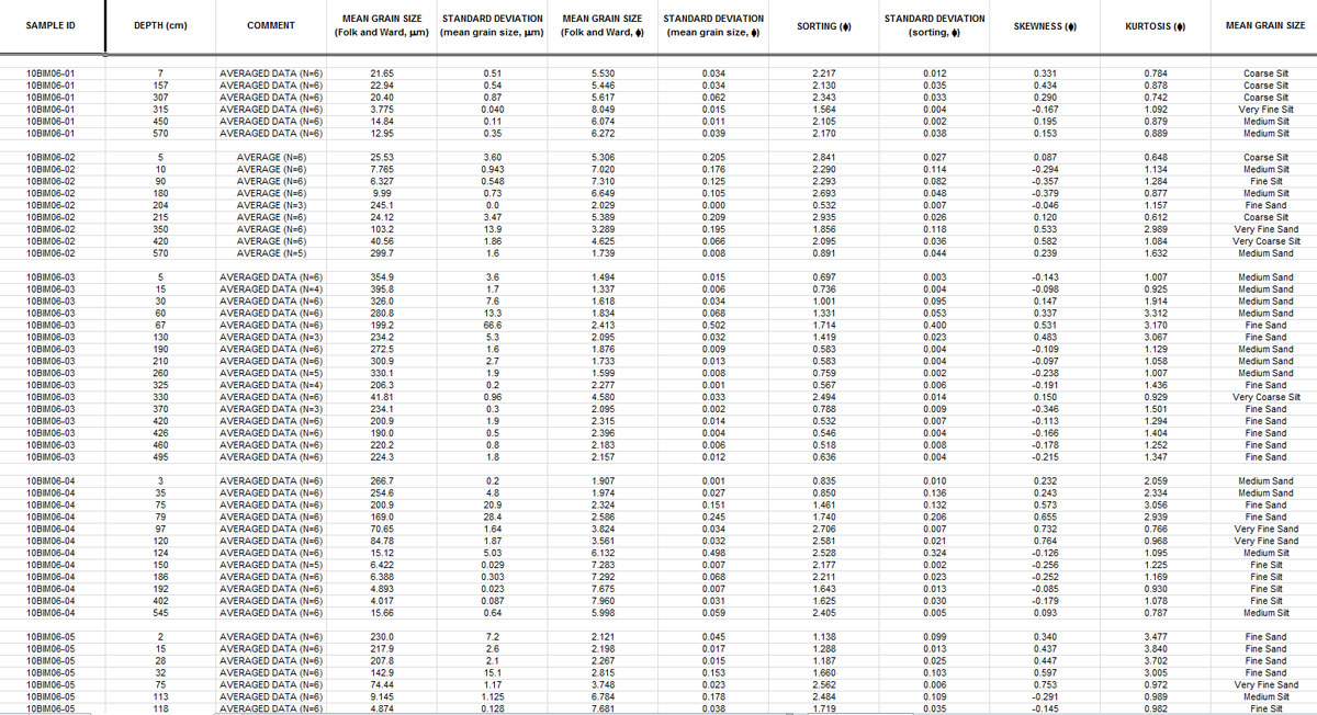
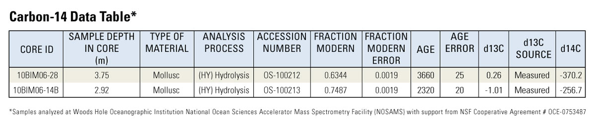
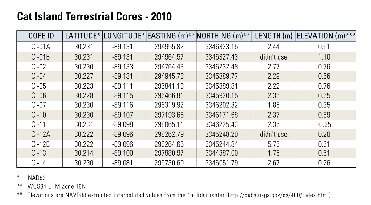
The sediment data described in this report, including descriptive core logs, core photographs, processed grain-size data, OSL tables, carbon-14 tables, sample location maps, and GIS data files with accompanying formal Federal Geographic Data Committee (FGDC) metadata, can be downloaded from the table below. Additionally, the core photos and logs can be viewed by clicking on the core locations on the sample location map (fig. 7). The images are provided as high-resolution JPEGs and can be viewed using standard image viewing software.
Core photos and logs are also provided in PDF format for download and can be viewed using the free software Adobe Reader (http://www.adobe.com/products/reader.html). The sample location tables and grain-size spreadsheets were created in Microsoft Excel 2010 (http://office.microsoft.com/) and can be opened using Microsoft Excel 2007 or higher. The GIS map documents and shapefiles provided in the data table were created using ESRI ArcGIS version 10.1 and can be opened using ESRI ArcGIS version 10.0 or higher; these data may also be viewed using the free GIS viewer ArcGIS Explorer (http://www.esri.com/software/arcgis/explorer). All sample locations and GIS data files presented this report use the projected coordinate system Universal Transverse Mercator (UTM) Zone 16 North (16N), and all elevations are North American Vertical Datum of 1988 (NAVD 88) orthometric heights, derived using the GEOID09 geoid model.
Data products and downloads
MARINE VIBRACORES
| Preview | File Description | File Format | Download File | Metadata |
|---|---|---|---|---|
 |
Marine core locations (GIS)
|
.shp |
||
 |
List of Marine cores |
.xlsx |
Marine_Vibracore_Table.zip (16 KB) |
|
 |
Core logs, grain size and photos - digital Core logs - handwritten |
.pdf |
Not applicable |
|
 |
Grain-size data Grain-size supplemental data |
.xlsx |
||
 |
Radiocarbon (C-14) data |
.xlsx |
TERRESTRIAL VIBRACORES
| Preview | File Description | File Format | Download File | Metadata |
|---|---|---|---|---|
 |
Terrestrial core locations (GIS) |
.shp |
||
 |
List of Terrestrial cores |
.xlsx |
Terrestrial_Vibracore_Table.zip (15 KB) |
|
 |
Core logs and photos-digital Core logs - handwritten |
.pdf |
Not applicable |
|
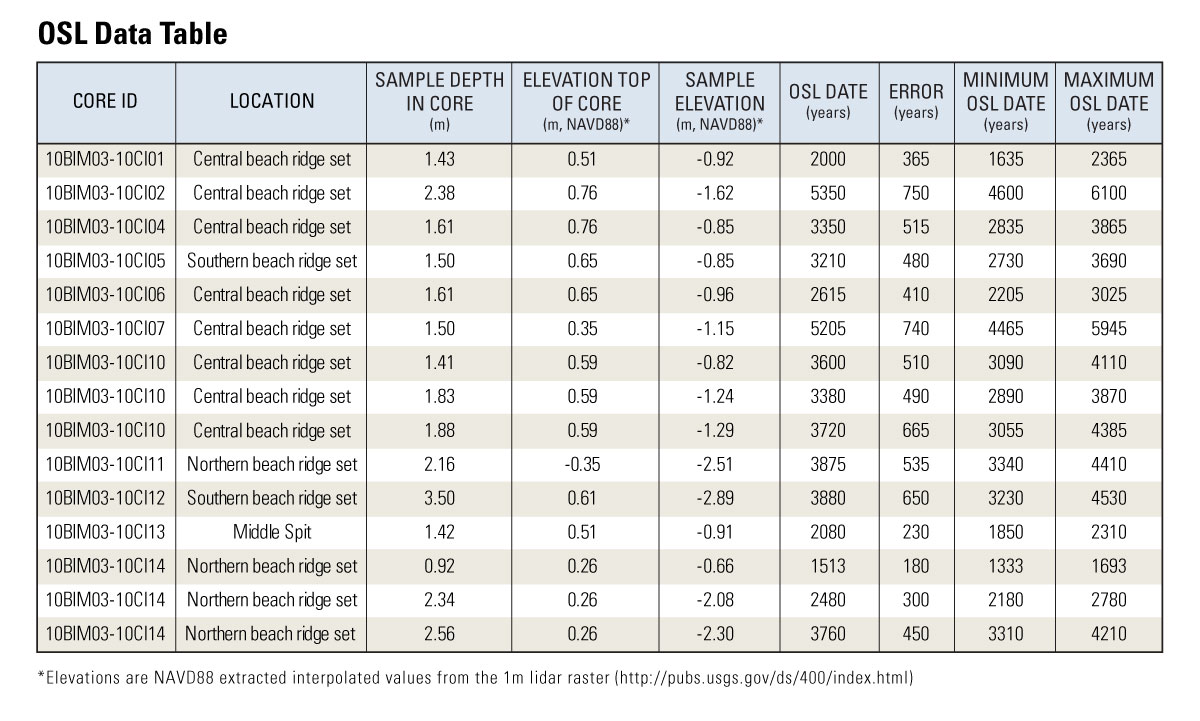 |
OSL data |
.xlsx |
OSL_Table.zip (16 KB) |
GIS DATA CATALOG
| Preview | File Description | File Format | Download File | Metadata |
|---|---|---|---|---|
 |
GIS catalog (core locations and shoreline) |
.shp |
The GIS data in this report are provided with a horizontal datum of WGS84 G1150 (equivalent to ITRF2000) UTM Zone 16N.
