Data Series 914
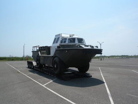
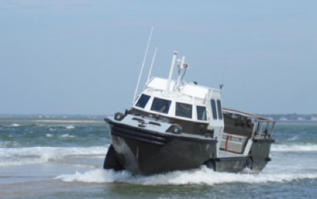
| Survey Overview and AcquisitionBathymetry data were collected by the USACE using the Lighter Amphibious Resupply Cargo (LARC) vessel. Forty-one shore-perpendicular transects with 50-meter (m) spacing were measured using a single-beam echosounder. A typical transect along the coast adjacent to the breach began at the foot of the dune and extended offshore to a water depth of approximately 8 m. For transects in the breach channel, the lines were extended from the 8 m isobaths to a point within the breach that the LARC could not safely traverse on the flood shoal. Navigation data were acquired and stored using HYPACK, Inc., and the data were differentially corrected using land-based global positioning system (GPS) stations. Raw datasets were stored digitally and processed systematically using HYPACK version 2013 in conjunction with a custom FORTRAN routine developed by researchers at the USACE FRF and ESRI ArcGIS version 10.2.1. VesselThe USACE LARC vessel was transported from Duck, N.C., to Fire Island, N.Y., via tractor trailer to conduct the bathymetry survey (fig. 3). The LARC vessel was used as the survey platform in order to collect continuous topographic and bathymetric data of the breach morphology, including the ebb shoal deposit on the ocean side of the breach. The ebb shoal is difficult to survey using traditional methods because of the shallow water and wave breaking conditions. The LARC is ideal for use in this environment because it is capable of being driven from the beach into the water and continuously collecting data in very shallow water (<1 m) and subaerial environments. The LARC typically surveys on the ground at approximately 8 kilometers per hour and transitions to speeds of about 7 kilometers per hour in the water (fig. 4). For more information on the USACE LARC survey system, see http://www.frf.usace.army.mil/larc/larcsystem.stm.
EquipmentThe LARC survey system uses HYPACK, Inc. hydrographic survey software to collect data. This software acts as an interface between the GPS data and the navigator in order to ensure that the LARC follows the pre-determined survey path. The LARC uses a Real-Time Kinematic Global Positioning System (RTK-GPS) to determine location and movement. The HYPACK software merges RTK-GPS data and echosounder data and creates raw data files that are post-processed and edited by staff at the USACE FRF using customized software. See http://www.frf.usace.army.mil/larc/larcsystem.stm for additional details of the USACE processing steps and equipment.
Knudsen 320BP Echosounder
Conductivity, Temperature, and Depth (CTD) Profiler
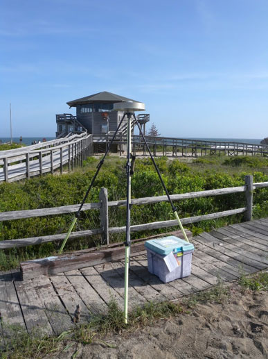
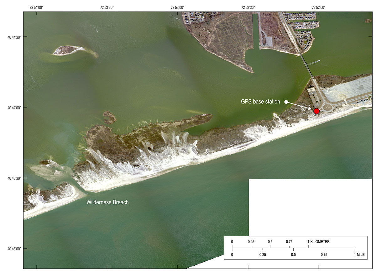
Real-Time Kinematic Global Positioning System (RTK-GPS) The LARC acts as a rover station, so its GPS antenna is not given a differentially fixed position. Instead, the LARC computes its location from available transmitting GPS satellites. After the location is determined, the correction from the base station is received and applied to that computed position to produce the differentially corrected position. This base station correction results in an accuracy of ±2.0 cm in all three dimensions.
|

![]() U.S. Department of the Interior |
U.S. Geological Survey
U.S. Department of the Interior |
U.S. Geological Survey
URL: http://pubsdata.usgs.gov/pubs/ds/0914/ds914_data-acquisition.html
Page Contact Information: GS Pubs Web Contact
Page Last Modified: Monday, 28-Nov-2016 20:31:27 EST