Data Series 914
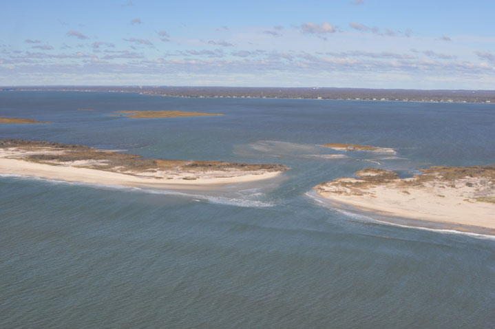
| Project SummaryIn October 2012, Hurricane Sandy created a breach on Fire Island (U.S. Geological Survey, 2014), one of the barrier islands along the southern coast of Long Island, New York (figs. 1-2). The breach became wider and migrated westward over the course of the winter of 2012–13. In order to obtain baseline bathymetric data and to inform decision support modeling, staff from the U.S. Army Corps of Engineers (USACE) Field Research Facility (FRF) in Duck, N.C., and scientists from the U.S. Geological Survey (USGS) St. Petersburg Coastal and Marine Science Center (SPCMSC) conducted a bathymetric survey of the breach on June 26, 2013. The objectives of the data collection were to map the morphology of the ebb shoal and the breach to support analysis of morphologic change to the barrier island, evolution of the breach, and hydrodynamic and morphodynamic modeling as part of the USGS Hurricane Sandy Supplemental Project GS2-2B (http://www.usgs.gov/hurricane/sandy/#research_themes.html!research_theme_understanding_change.html).
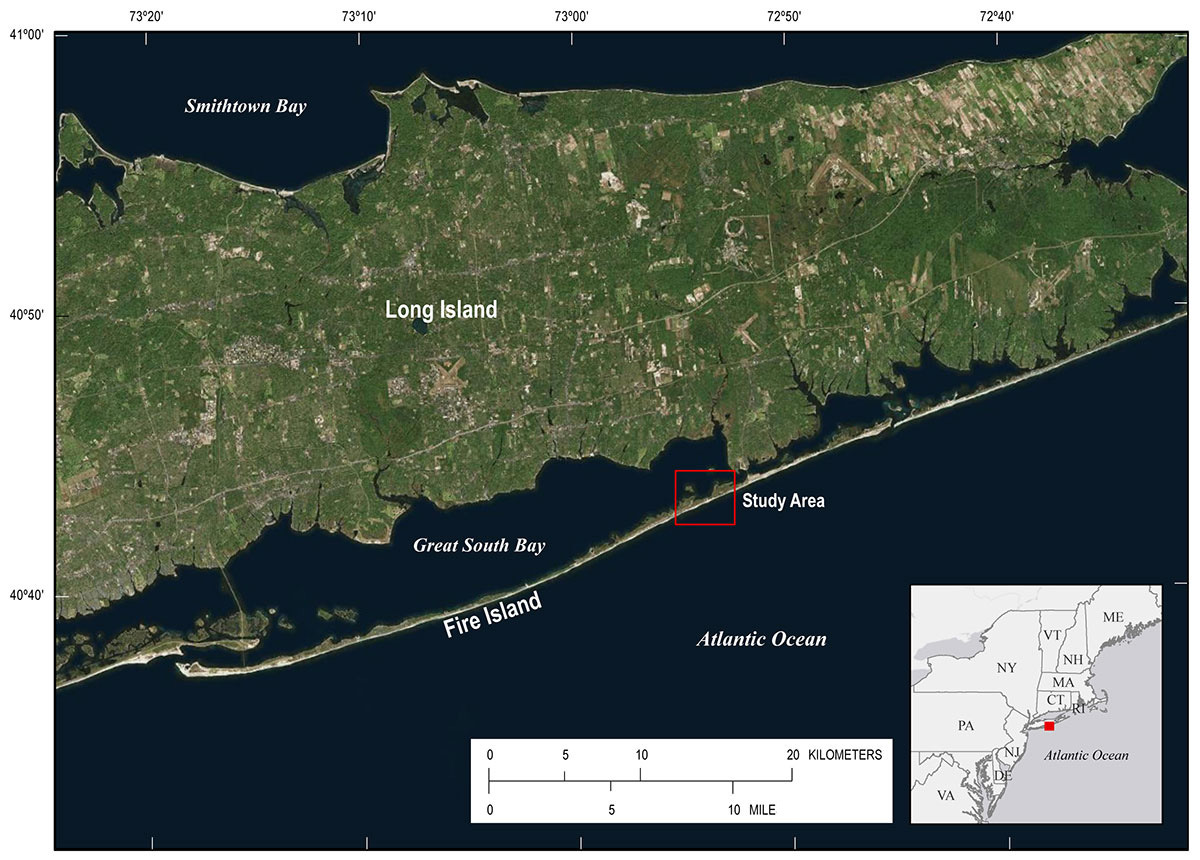 Figure 2: Location of the breach caused by Hurricane Sandy in 2012, on the eastern end of Fire Island south of Long Island, New York. Background image is from ESRI Map Service, World Light Gray Base. [larger version] |

![]() U.S. Department of the Interior |
U.S. Geological Survey
U.S. Department of the Interior |
U.S. Geological Survey
URL: http://pubsdata.usgs.gov/pubs/ds/0914/ds914_summary.html
Page Contact Information: GS Pubs Web Contact
Page Last Modified: Monday, 28-Nov-2016 20:31:23 EST