Data Series 1081
| IntroductionThe Gulf Islands National Seashore (GUIS) is composed of a series of barrier islands along the Mississippi and Alabama coastlines. The nearshore environment of the Mississippi barrier islands is highly dynamic. Sediment transport is driven by wave-induced cross-shore and alongshore processes. These processes can be measured using repeat bathymetric surveys to record elevation change over time and provide information about depositional and erosional systems. The National Park Service (NPS) is responsible for preserving and maintaining the history of the GUIS, especially historic sites such as Fort Massachusetts on West Ship Island. Ship Island was historically a single island; however, numerous hurricanes breached the island, and in 1969, Hurricane Camille split it into West Ship Island and East Ship Island. In 2007, the U.S. Geological Survey (USGS) St. Petersburg Coastal and Marine Science Center (SPCMSC) provided the NPS with a post-Hurricane Katrina single-beam bathymetric (SBB) survey conducted within Camille Cut and along the shoreface near Fort Massachusetts on the Mississippi Sound side of West Ship Island (DeWitt and others, 2012c). Since 2007, the USGS has worked in cooperation with the NPS under the USGS Northern Gulf of Mexico (NGOM) project and with the U.S. Army Corps of Engineers (USACE) under the Mississippi Coastal Improvements Program (MsCIP) to measure seafloor elevation using interferometric swath bathymetry (IFB) and single-beam bathymetry (SBB) (Pfeiffer and others, 2011; DeWitt and others, 2012a, 2012b, 2012c, 2015, 2017). These studies have provided information on seafloor morphology, morphology change, and near surface geology (Twichell and others, 2011; Flocks and others, 2015, 2018) and have helped coastal managers to identify sand resources for use in shoreline restoration projects. The objective of the current study was to establish base-level elevation conditions around West Ship, East Ship, and Horn Islands, Gulf Islands National Seashore, Mississippi, prior to restoration activities. The surveys can be compared to future surveys to monitor post-restoration change and can be used to supplement historic bathymetric datasets (Buster and Morton, 2011; Buster and others, 2017). The restoration activities include the closure of Camille Cut and associated sediment placements within the littoral zone of East Ship Island. The restoration is intended in part to enhance the long-term resilience of the Mississippi barrier islands. In July 2016, the USGS SPCMSC conducted IFB and SBB surveys in the nearshore coastal waters around West Ship, East Ship, and Horn Islands and in the associated passes (Camille Cut, Dog Keys Pass, and Horn Island Pass) (fig. 1). During Field Activity Number (FAN) 2016-347-FA, the USGS collected over 1,500 line-kilometers (km) of data and generated over four million data points that were used to produce a digital elevation model (DEM). The bathymetric data acquisition and processing methods are discussed in this report. The data products, including x,y,z data point files, DEM, metadata, and Field Activity Collection System (FACS) files, can be downloaded from the Data Downloads page or the associated USGS data release (DeWitt and others, 2017). 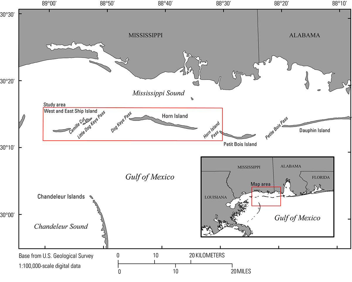 Figure 1. Map showing the 2016 bathymetry survey extent around Ship (West and East) and Horn Islands, Gulf Islands National Seashore, Mississippi. [Click figure to enlarge]
|

![]() U.S. Department of the Interior |
U.S. Geological Survey
U.S. Department of the Interior |
U.S. Geological Survey
URL: http://pubsdata.usgs.gov/pubs/ds/1081/ds1081_intro.html
Page Contact Information: GS Pubs Web Contact
Page Last Modified: Thursday, 12-Apr-2018 12:16:05 EDT
