
Multibeam Sonar Mapping and Modeling of a Submerged Bryophyte Mat in Crater Lake, Oregon
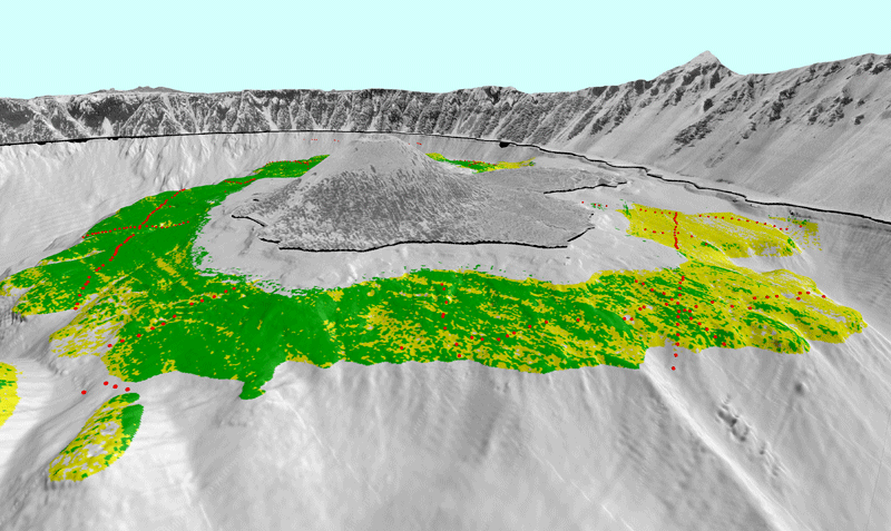
View 2. Perspective view looking south toward Wizard Island (center) showing the distribution of the bryophyte mat (moss) over Wizard Island platform. Green shades show thicker, continuous mats of moss, whereas yellow shades show areas with thinner, patchy coverage. The red dots show points where moss was observed during the August 2006 camera sled ground-truthing cruise. The vertical exaggeration in this image is 2X.
View Full-Size Image (640 Kb)
For more information contact: Peter Dartnell
