U.S. Geological Survey Data Series 671
Differential navigation was acquired using a local National Geodetic Survey (NGS) Continuously Operating Refernce Station (CORS) beacon that broadcasts carrier phase and code range measuremtents that are captured in real time using the the Applanix Position and Orientation System for Marine Navigation (POS MV). Ship navigation was displayed and recorded using HYPACK version 10. The multibeam bathymetry and side scan sonar data were collected simultaneously using HYSWEEP version 10 and SonarPro version 11.3, respectively. The multibeam bathymetry and the side scan sonar data were collected with separate instruments but utilized the same navigation string from the Applanix POS MV. The ship trackline navigation map covered more than 380 km (fig. 3). This map differs slightly in coverage and length from the processed multibeam and side scan trackline maps, which produced 373 km and 351 km of tracklines, respectively (fig. 4 and fig. 5). These differences resulted from technical issues including but not limited to data loss due to equipment malfunction or poor data quality. The trackline maps were created with ESRI ArcGIS version 9.3.1 software.

Figure 3. Map showing vessel trackline coverage for cruise 10CCT03, offshore Gulf Islands National Seashore. |

Figure 4. Map showing processed multibeam trackline coverage for cruise 10CCT03, offshore Gulf Islands National Seashore. |
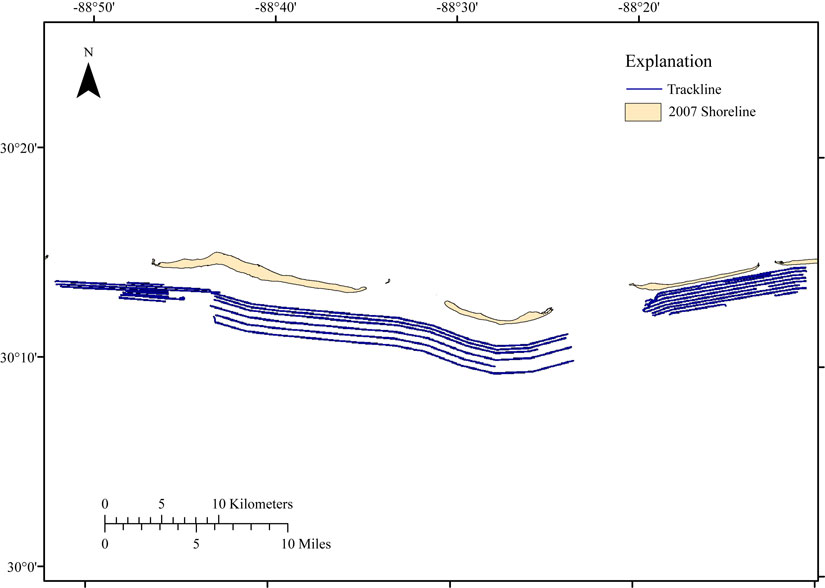
Figure 5. Map showing processed side scan trackline coverage from cruise 10CCT03, offshore Gulf Islands National Seashore. |

![]() U.S. Department of the Interior |
U.S. Geological Survey
U.S. Department of the Interior |
U.S. Geological Survey
URL: http://pubsdata.usgs.gov/pubs/ds/671/html/nav.html
Page Contact Information: GS Pubs Web Contact
Page Last Modified: Monday, 28-Nov-2016 18:39:25 EST