U.S. Geological Survey Data Series 722
Select an Image |
Single-Beam 50-m Bathymetric Grid |
Single-Beam 1-meter Labeled Bathymetric Contours |
Shown below are the GeoTIFF images of the 50-m single-beam bathymetry (fig. 11) and the 50-m single-beam bathymetry with 1-meter labeled contours (fig. 12).
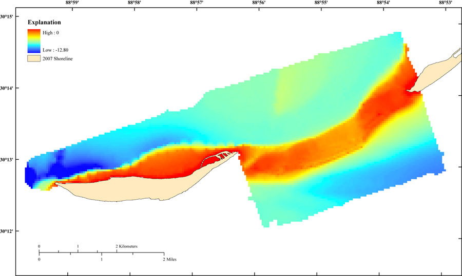
Figure 11. Image of the gridded 07CCT01 single-beam bathymetric data. The cell size is 50 meters, and the data range is 0 to -12.82 meters, with the positive values representing the shoreline and the negative values representing the bathymetry. Shoreline file is from 2007 processed EAARL LiDAR. [larger version] |
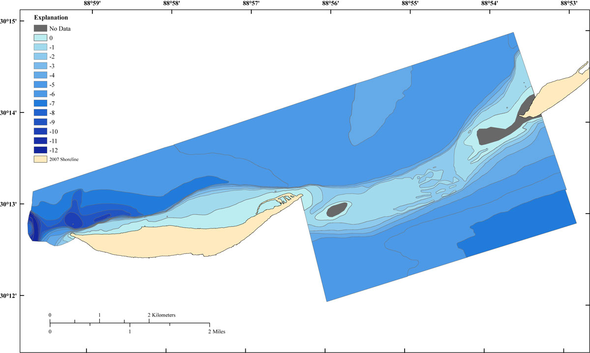
Figure 12. Image of the 07CCT01 50-meter gridded single-beam bathymetric data as 1-meter labeled colored contours. Shoreline file is from 2007 processed EAARL LiDAR. [larger version] |

![]() U.S. Department of the Interior |
U.S. Geological Survey
U.S. Department of the Interior |
U.S. Geological Survey
URL: http://pubsdata.usgs.gov/pubs/ds/722/html/images.html
Page Contact Information: GS Pubs Web Contact
Page Last Modified: Monday, 28-Nov-2016 19:05:15 EST
