California State Waters Map Series Data Catalog
Maps that show these data are published in Scientific Investigations Map 3225, "California State Waters Map Series--Hueneme Canyon and Vicinity, California."
Each GIS data file for the Hueneme Canyon and Vicinity map area is listed below with a brief description, a small image, and links to the metadata files and the downloadable data files. The data were compiled in ArcMap (version 10.0, ESRI, 2011). Raster data layers are registered TIFF images and are in the UTM Zone 11 coordinate system, with datum WGS84. Point, line, and polygon features are in shapefile format and are projected in UTM Zone 11 coordinates, with horizontal datum WGS84. We recommend that you create a single new folder within which to unzip the files you want to use.
The downloadable data files have been compressed with the "zip" command, and they can be unzipped with Winzip (or other tool) on Windows systems. The .zip file for a TIFF image includes the image (.tif), the world registration file (.tfw), and the text (.txt) and XML (.tif.xml) versions of the metadata. The .zip for a shapefile includes the .aux, .dbf, .shp, .shx, .sbx, and .sbn files, as well as the text (.txt) and XML (.shp.xml) versions of the metadata.
Web services were created using an ArcGIS service definition file. The ArcGIS REST service and OGC WMS service include all Hueneme Canyon and Vicinity data layers listed in the "GIS Data Files" table. Data layers are symbolized as shown on the associated map sheets. Individual web services for each GIS file are available from the main service pages provided in the links below.
ArcMap users: Instructions to use these services in ArcMap version 10.0 or above.
HuenemeCanyonGIS.mxd.zip (0.2 MB) is a compressed (with the "zip" command) version of the ArcMap document (.mxd) that has all the data layers loaded in the table of contents and has all the data symbolized as on the SIM map sheets. Download and save this ArcGIS project file, including all data layers, to the directory you created for this GIS.
Date last modified: August 8, 2013
| Theme Description | View | File Format | Metadata | File Compressed | File Size |
|---|---|---|---|---|---|
| Bathymetry (2m/pixel), Hueneme Canyon and Vicinity map area | 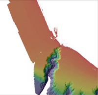 |
TIFF 32 bit float |
txt, xml, html, faq | Bathymetry_HuenemeCanyon.zip | 130 MB |
| Bathymetry Hillshade (2m/pixel), Hueneme Canyon and Vicinity map area | 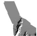 |
TIFF 8 bit float |
txt, xml, html, faq | BathymetryHS_HuenemeCanyon.zip | 24 MB |
| Contours, Hueneme Canyon and Vicinity map area | 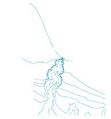 |
ESRI Shapefile (line) |
txt, xml, html, faq | Contours_HuenemeCanyon.zip | 1.2 MB |
| Backscatter (2m/pixel), collected by CSUMB, reprocessed by USGS, Hueneme Canyon and Vicinity map area | 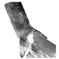 |
TIFF 8 bit float |
txt, xml, html, faq | BackscatterA_CSUMB_HuenemeCanyon.zip | 35 MB |
| Backscatter (2m/pixel), collected and processed by USGS, Hueneme Canyon and Vicinity map area |  |
TIFF 8 bit float |
txt, xml, html, faq | BackscatterB_USGS_HuenemeCanyon.zip | 0.7 MB |
| Offshore Geology and Geomorphology, Hueneme Canyon and Vicinity map area | 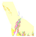 |
ESRI Shapefile (polygon) |
txt, xml, html, faq | Geology_HuenemeCanyon.zip | 0.3 MB |
| Faults, Hueneme Canyon and Vicinity map area |  |
ESRI Shapefile (line) |
txt, xml, html, faq | Faults_HuenemeCanyon.zip | 0.1 MB |
| Folds, Hueneme Canyon and Vicinity map area |  |
ESRI Shapefile (line) |
txt, xml, html, faq | Folds_HuenemeCanyon.zip | 0.1 MB |
| Paleoshorelines, Hueneme Canyon and Vicinity map area |  |
ESRI Shapefile (line) |
txt, xml, html, faq | Paleoshorelines_HuenemeCanyon.zip | 0.1 MB |
| Submarine Landslide Scarps, Hueneme Canyon and Vicinity map area |  |
ESRI Shapefile (line) |
txt, xml, html, faq | SubmarineLandslideScarps_HuenemeCanyon.zip | 0.1 MB |
| Habitat, Hueneme Canyon and Vicinity map area | 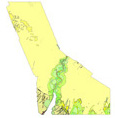 |
ESRI Shapefile (polygon) |
txt, xml, html, faq | Habitat_HuenemeCanyon.zip | 0.5 MB |
| Seafloor Character (2m/pixel), Hueneme Canyon and Vicinity map area | 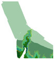 |
TIFF 32 bit integer |
txt, xml, html, faq | SeafloorCharacter_HuenemeCanyon.zip | 1.5 MB |
| Curvature (2m/pixel), Hueneme Canyon (canyon only) | 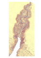 |
TIFF 32 bit Float |
txt, xml, html, faq | Curvature_HuenemeCanyon.zip | 28 MB |
| Slope (2m/pixel), Hueneme Canyon (canyon only) | 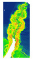 |
TIFF 32 bit Float |
txt, xml, html, faq | Slope_HuenemeCanyon.zip | 46 MB |
| Depth To Transition, Santa Barbara Channel | 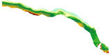 |
ESRI Shapefile (line) |
txt, xml, html, faq | DepthToTransition_SantaBarbaraChannel.zip | 1.5 MB |
| Transgressive Contours, Santa Barbara Channel | 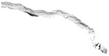 |
ESRI Shapefile (line) |
txt, xml, html, faq | TransgressiveContours_SantaBarbaraChannel.zip | 0.7 MB |
| Sediment Thickness (2m/pixel), Santa Barbara Channel | 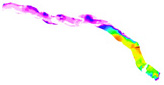 |
TIFF 32 bit Float |
txt, xml, html, faq | SedimentThickness_SantaBarbaraChannel.zip | 1.6 MB |
| Isopachs, Santa Barbara Channel | 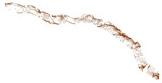 |
ESRI Shapefile (line) |
txt, xml, html, faq | Isopachs_SantaBarbaraChannel.zip | 0.7 MB |
| Predicted Distribution of Brittle Stars, Santa Barbara Channel | 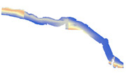 |
TIFF 32 bit Float |
txt, xml, html, faq | BrittleStars_SantaBarbaraChannel.zip | 887 MB |
| Predicted Distribution of Cup Corals, Santa Barbara Channel | 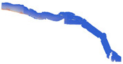 |
TIFF 32 bit Float |
txt, xml, html, faq | CupCorals_SantaBarbaraChannel.zip | 891 MB |
| Predicted Distribution of Hydroids, Santa Barbara Channel | 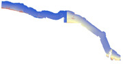 |
TIFF 32 bit Float |
txt, xml, html, faq | Hydroids_SantaBarbaraChannel.zip | 884 MB |
| Predicted Distribution of Short Sea Pens, Santa Barbara Channel |  |
TIFF 32 bit Float |
txt, xml, html, faq | ShortSeaPens_SantaBarbaraChannel.zip | 889 MB |
| Predicted Distribution of Tall Sea Pens, Santa Barbara Channel |  |
TIFF 32 bit Float |
txt, xml, html, faq | TallSeaPens_SantaBarbaraChannel.zip | 877 MB |
| Visual observations of benthic habitat from video USGS Cruise S1C08SC |  |
ESRI Shapefile (points) |
txt, xml, html, faq | s1c08sc_video_observations.zip | 0.2 MB |
| Visual observations of benthic habitat from video USGS Cruise Z107SC |  |
ESRI Shapefile (points) |
txt, xml, html, faq | z107sc_video_observations.zip | 0.1 MB |

![]() U.S. Department of the Interior |
U.S. Geological Survey
U.S. Department of the Interior |
U.S. Geological Survey
URL: http://pubsdata.usgs.gov/pubs/ds/781/HuenemeCanyon/data_catalog_HuenemeCanyon.html
Page Contact Information: GS Pubs Web Contact
Page Last Modified: Monday, 28-Nov-2016 19:16:25 EST
