Link to USGS home page
Coastal and Marine Geology Program
Coastal & Marine Geology Program >Subsidence and Fault Activation . . . >Fact Sheet FS-091-01

Return to: Subsidence & Hydrocarbon Production | Regional Depressurization | Correlations & Rates

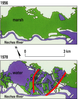
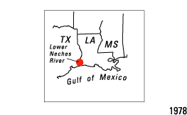
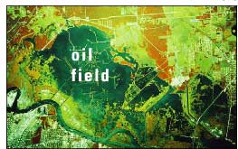
Figure 2. Air photograph of the Port Neches oil and gas field in Texas in 1978 and maps showing that wetlands above the field were healthy and continuous in 1956 but deteriorated and were converted to open water by 1978. The change was caused by induced subsidence and fault reactivation resulting from hydrocarbon production. From White and Morton (1997). Relative motion along faults: D, down; U, up.
Maps showing that wetlands above the field were healthy and continuous in 1956 but deteriorated and were converted to open water by 1978. lcoation map
Air photograph of the Port Neches oil and gas field in Texas in 1978.

Return to: Subsidence & Hydrocarbon Production | Regional Depressurization | Correlations & Rates

Coastal & Marine Geology Program >Subsidence and Fault Activation . . . >Fact Sheet FS-091-01

[an error occurred while processing this directive]