 Introduction Introduction
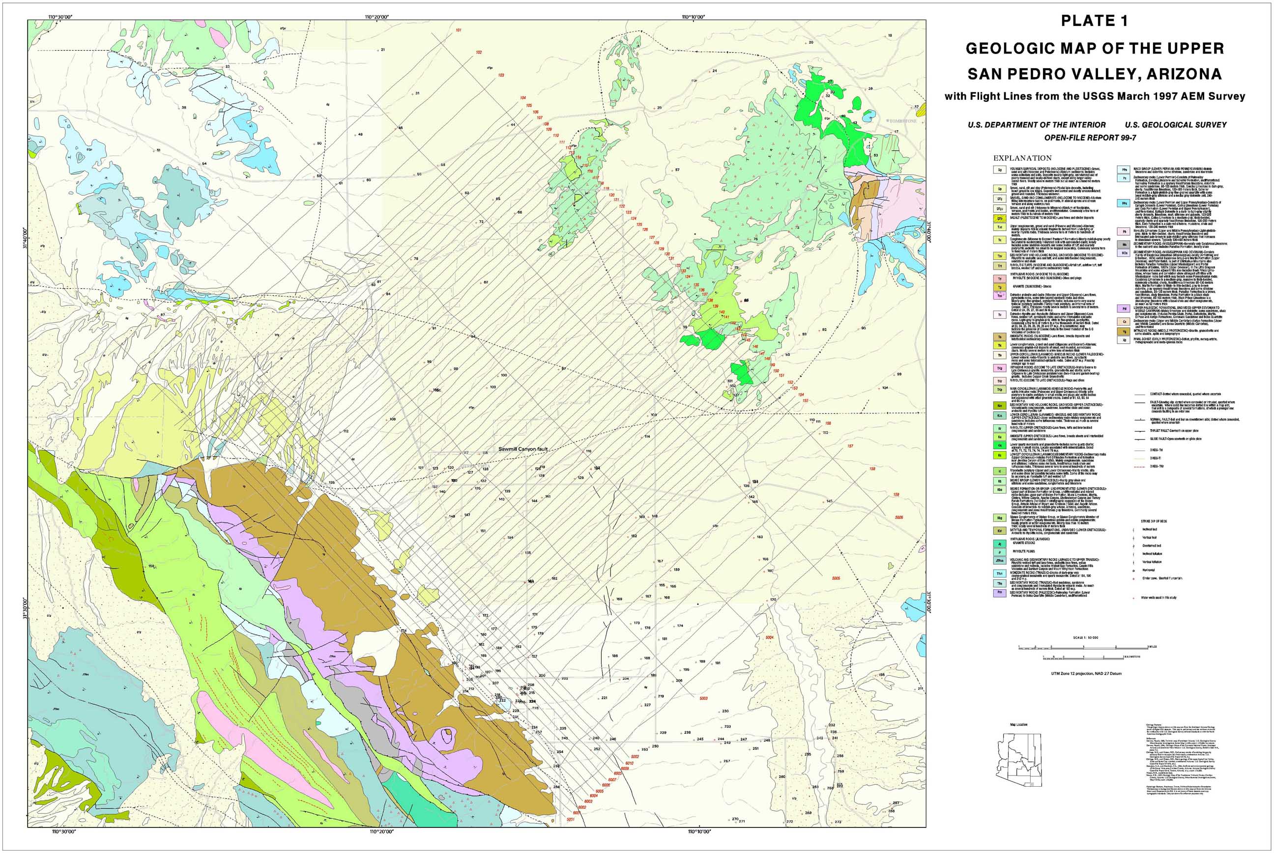
In March of 1997, an airborne electromagnetic (AEM) survey of the Fort Huachuca Military Reservation and immediate surrounds was conducted. This survey was sponsored by the U.S. Army and contracted through the Geologic Division of the U.S. Geological Survey (USGS). Data were gathered by Geoterrex-Dighem Ltd. of Ottawa, Canada. The survey aircraft is surrounded by a coil through which a large current pulse is passed. This pulse induces currents in the Earth which are recorded by a set of three mutually perpendicular coils towed in a "bird" about 100 m behind and below the aircraft. The bird also records the Earth's magnetic field. The system samples the Earth response to the electromagnetic pulse about every 16 m along the aircraft flight path. For this survey, the bulk of the flightpaths were spaced about 400 m apart and oriented in a northeast-southwest direction extending from bedrock over the Huachuca Mountains to bedrock over the Tombstone Hills. A preliminary report on the unprocessed data collected in the field was delivered to the U.S. Army by USGS in July 1997 (USGS Open-File Report 97–457). The final data were delivered in March, 1998 by the contractor to USGS and thence to the U.S. Army. The present report represents the final interpretive report from USGS.
The objectives of the survey were to: 1) define the structure of the San Pedro basin in the Sierra Vista-Fort Huachuca-Huachuca City area, including the depth and shape of the basin, and to delineate large faults that may be active within the basin fill and therefore important in the hydrologic regime; 2) define near surface and subsurface areas that contain a large volume fraction of silt and clay in the basin fill and which both reduce the volume of available storage for water and reduce the permeability of the aquifer; and 3) to evaluate the use of the time domain electromagnetic method in the southwest desert setting as a means of mapping depth to water.
|
First posted February 9, 2000
Part or all of this report is presented in Portable Document Format (PDF). For best results viewing and printing PDF documents, it is recommended that you download the documents to your computer and open them with Adobe Reader. PDF documents opened from your browser may not display or print as intended. Download the latest version of Adobe Reader, free of charge.
|

