| |
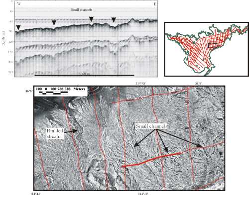
Surficial Geology and Distribution of Post-Impoundment Sediment of the Western Part of Lake Mead Based on a Sidescan Sonar and High-Resolution Seismic-Reflection SurveyFigure 10. Sidescan sonar image showing part of a submerged alluvial fan (location in inset map). The fine, downslope-trending, low backscatter lineations represent the floors of a network of small channels that sculpt the surface of this alluvial fan. One of the larger channels appears to be a braided stream. Seismic profile shows that these channels mostly have less than 5-m relief (0.2 sec. TWT is approximately 15 m), and that there is no sediment cover on the alluvial fan. Click on figure for larger image. | ||||||||||||
|
||||||||||||
| ||||||||||||
| ||||||||||||
|
||||||||||||