| |
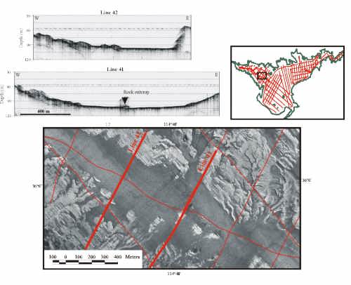
Surficial Geology and Distribution of Post-Impoundment Sediment of the Western Part of Lake Mead Based on a Sidescan Sonar and High-Resolution Seismic-Reflection SurveyFigure 12.. Sidescan sonar image from Las Vegas Bay (location in inset) showing the low-backscatter sediment cover in the narrow valley floor and the high-backscatter signature from the rock faces adjacent to the floor. Sediment cover is thin as patches of high-backscatter rock outcrop are present in the floor of the valley. Seismic profiles (locations shown on sidescan image) show the flat-floored nature of the valley and that sediment here is less than 2 m thick. Note rock outcrop on line 41 that also shows on the sidescan image. | ||||||||||||
|
||||||||||||
| ||||||||||||
| ||||||||||||
|
||||||||||||