Surficial Geology and Distribution of Post-Impoundment Sediment of the Western Part of Lake Mead Based on a Sidescan Sonar and High-Resolution Seismic-Reflection Survey
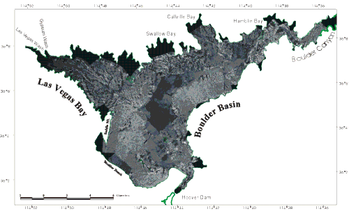
Figure 4. Sidescan sonar mosaic of the Boulder Basin and Las Vegas Bay parts of Lake Mead. On this image, strong acoustic returns (high-backscatter) are shown by the white and light gray shades while weak acoustic returns (low-backscatter) are shown by the black and dark gray shades. Solid black areas around the edge of the lake were not imaged by the sidescan system.
|