This ArcView 3.0a project contains 3 views.
(The Spatial Analyst Extension is required for viewing the DEMs in this project)View
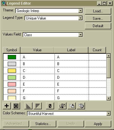
one contains coverages in the Geographic Coordinate System (lat, lon). The Geol Interp
coverage should be sorted according to class. The geol3.avl legend file can be copied into
your Arcview symbols directory and then loaded through the legend editor. |
 |
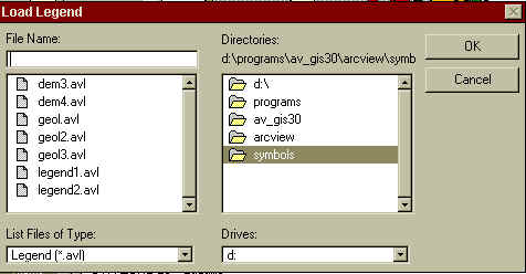 |
| The DEMs can be set up with the same method as above using
the file dem4.avl found in the dem directory on this CD. |
| View two contains the files found in view one, this time
projected into UTM Zone 19, reference spheroid WGS 84.. Puerto Rico is split into two UTM
Zones, 19 and 20. The Mayaguez area data, also shown in View two, is in Zone 19. |
| View three contains the files found in View one, this time in
UTM Zone 20 Projection, reference spheroid WGS 84.. The Luquillo area data, also shown in
View three, is in UTM Zone 20. |
TABLE OF CONTENTS
|
GLORIA
| SLAR | LINEAMENTS | NEOTECTONIC SETTING | SURFICIAL SEDIMENT MAP | FE-MN NODULES
SEDIMENTARY PROCESSES | GIS
DATA | SAND AND GRAVEL | CONTACTS
| HOME
SLOPE FAILURE | ARCEXPLORER
| ARCVIEW | FIGURES |
[an error occurred while processing this directive]