|
PHOTOGRAPHS |
|
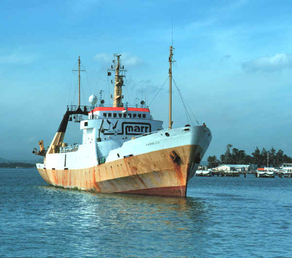
The research vessel Farnella, owned by J. Marr, LTD, entering the harbor at San Juan, Puerto Rico. This ship was used for a joint American/British program to map the seafloor of the U.S. Exclusive Economic Zone (EEZ, the area with in 200 miles of U.S. shores) using the GLORIA long-range sidescan sonar system. The U.S. Geological Survey and Britain’s Institute of Oceanographic Sciences (now Southampton Oceanographic Center) carried out the field work in the Puerto Rico and U.S Virgin Islands EEZ in 1985. (Photo Credit: Dann Blackwood, Woods Hole Field Center) |