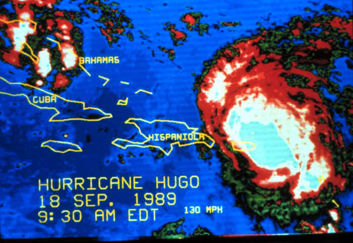
Enhanced infrared imagery of Hurricane Hugo on the morning of September 18, 1989.
Hugo was centered near the northeast tip of Puerto Rico. The storm had weakened to a
Category 3 on Saffir-Simpson at this time. (Photo Credit:
National Oceanic and Atmospheric Administration /Dept. of Commerce -- National Hurricane
Center)