
IMAGERY: |
|||
|
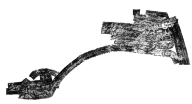
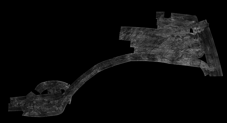
SeaMARC 1A mosaic
Available Imagery
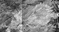
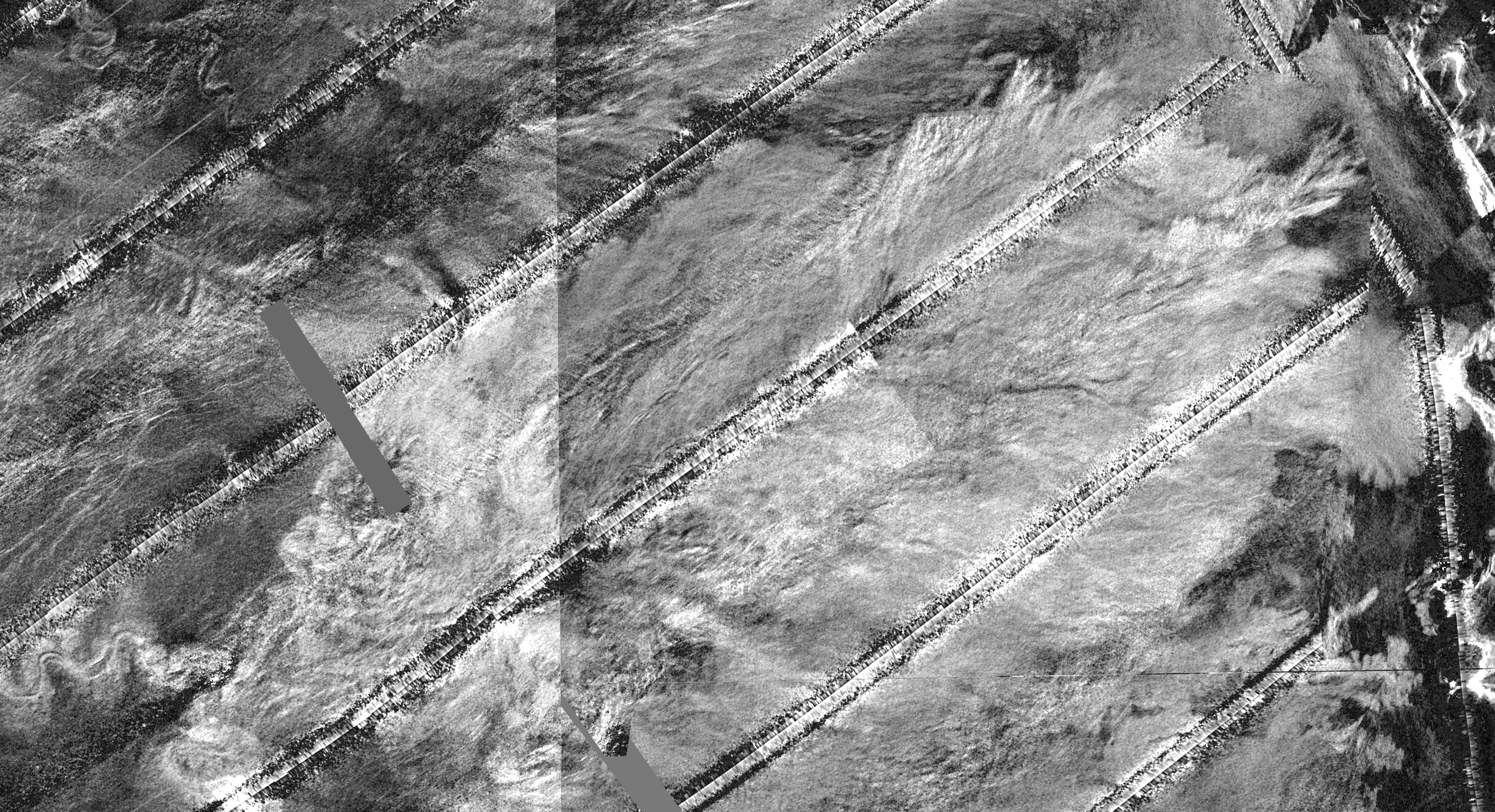
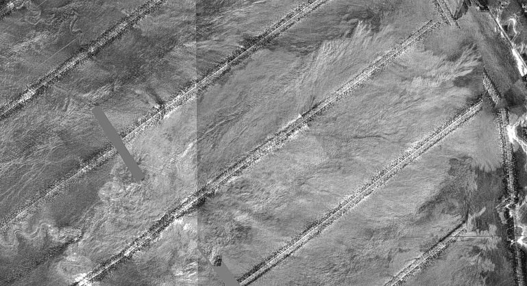
The purpose the R/V FARNELLA cruise was to complete the field work portion of a ground-truth program focusing on a depositional lobe in the eastern portion of the Mississippi Fan. This area had been mapped in 1985 using the GLORIA (Geologic Long-Range Inclined Asdic) sidescan sonar system. During the first leg of this cruise, a total of 3,466 square km of sidescan sonar data were collected utilizing the SeaMARC 1A sidescan sonar system. The SeaMarc 1A system provided a higher resolution image compared to the GLORIA sidescan system. The collected data were processed as part of the post-cruise data compilation and digitally mosaicked to create the 25 meter UTM projected mosaic released on this CD-ROM.
In addition to the SeaMARC 1A sidescan sonar mosaic, the GLORIA data for the corresponding area is also included. The GLORIA sidescan sonar mosaics were completed in 1985. These mosaics were produced at a 50 meter resolution in the Albers Equal Area projection and each covered a 2 degree by 2 degree area. The SeaMARC 1A survey area covered a portion of two separate and adjacent GLORIA mosaics. Those two mosaics were combined, re-sampled and re-projected to create a 25 meter mosaic that is registered with the SeaMARC 1A mosaic.Additionally, a 250 m resolution mosaic of the entire GLORIA data set for the Gulf of Mexico is also available on this CD-ROM. This image has been used in the MSFAN overview display in the ArcView project file.
For each of the archived 25 m image data sets formats, there are two sets of images: an enhanced image and an unenhanced image. Because the dynamic range of the data sets is rather low, one set of images have been radiometrically enhanced to improve viewing. These enhanced images are used in the Mississippi Fan views contained in the ArcView project file. A second set of unenhanced images are available for user's who wish to enhance the imagery themselves.
| Filename | Description | Additional Information | |||||
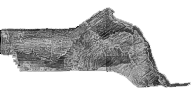
seamarc.tif
|
The 25 meter SeaMARC 1A sidescan sonar mosaic for the study area. The seamarc.tif image is used in the ESRI ArcView project MSFAN25m view. The image has a white background surrounding the sidescan sonar mosaic. This background has been made transparent in the Arcview project file. |
|
|||||
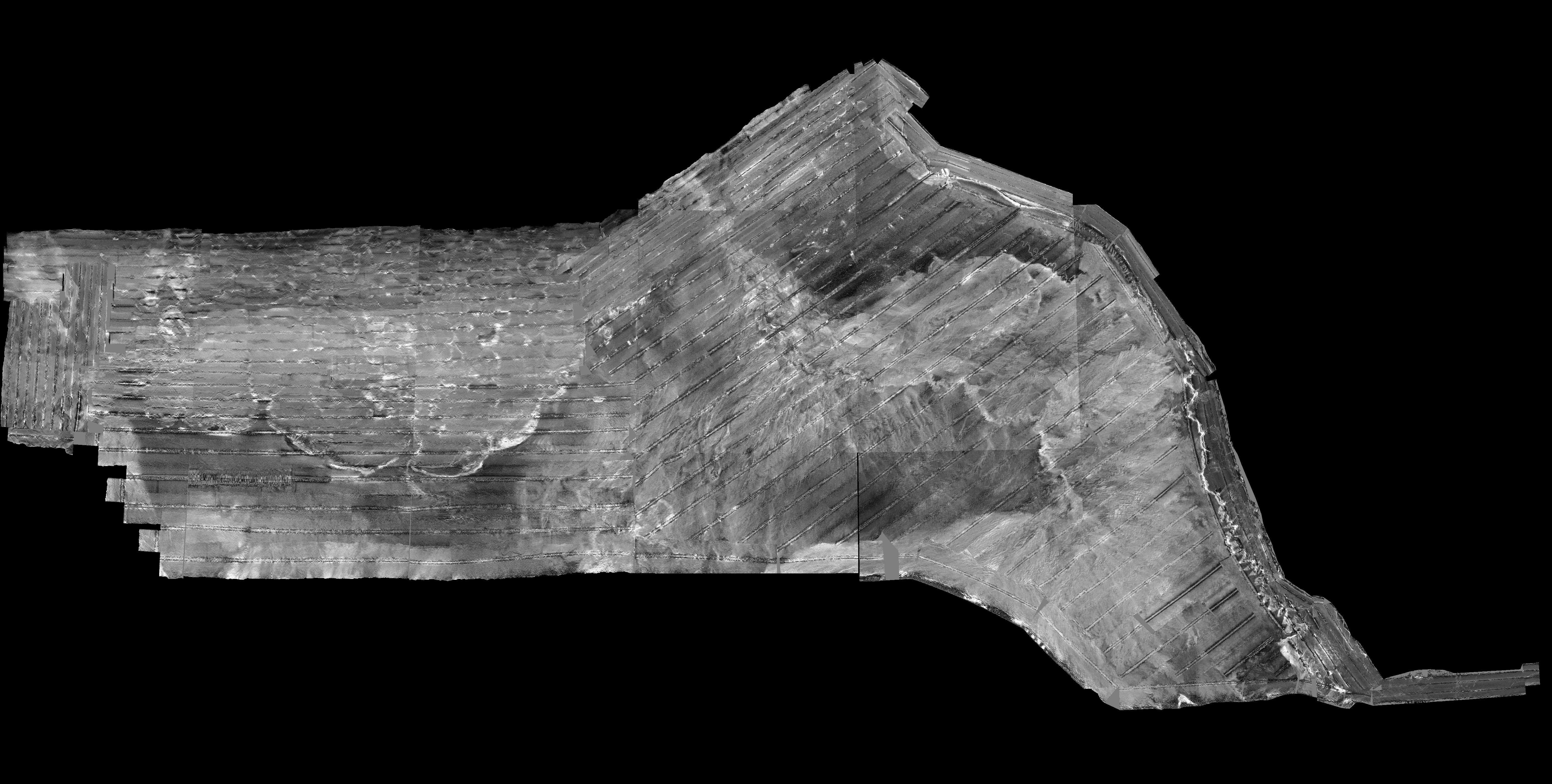
gloria.tif
|
The 25 meter GLORIA sidescan sonar mosaic for the corresponding SeaMARC study area. The gloria.tif image is used in the ESRI ArcView project MSFAN25m view. |
|
|||||
| Directory: data/imagery/enhanced | |||||||
| Filename | Description | Additional Information | |||||
seamarc.tif
|
The 25 meter SeaMARC 1A sidescan sonar mosaic for the study area. These images are not used in any ESRI ArcView project files. These images have not been enhanced. They are included here as an alternative to the enhanced images described above for user's who wish to apply their own radiometric corrections. |
|
|||||
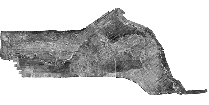
gloria.tif
|
The 25 meter GLORIA sidescan sonar mosaic for corresponding SeaMARC study area. These images are not used in any ESRI ArcView project files. These images have not been enhanced. They are included here as an alternative to the enhanced images described above for user's who wish to apply their own radiometric corrections. |
|
|||||
| Directory: data/imagery/raw | |||||||
250 m GLORIA mosaic
The 250 m GLORIA mosaics are only available in an enhanced image.
| Filename | Description | Additional Information | |||||
compos.tif
jpeg file |
The 250 meter GLORIA sidescan sonar mosaic for the Gulf of Mexico area in Albers Equal Area projection. The compos.tif image is used in the ESRI ArcView project MSFAN overview view and has a black background surrounding the sidescan sonar mosaic area. The black area has been made transparent for display in the view. |
|
|||||
composw.tif
jpeg file |
The 250 meter GLORIA sidescan sonar mosaic for the Gulf of Mexico area in Albers Equal Area projection. These image are similar to the images described above but have a white background surrounding the sidescan sonar mosaic area. |
|
|||||
| Directory: data/gloria | |||||||