Holocene Evolution, OFR 01-076
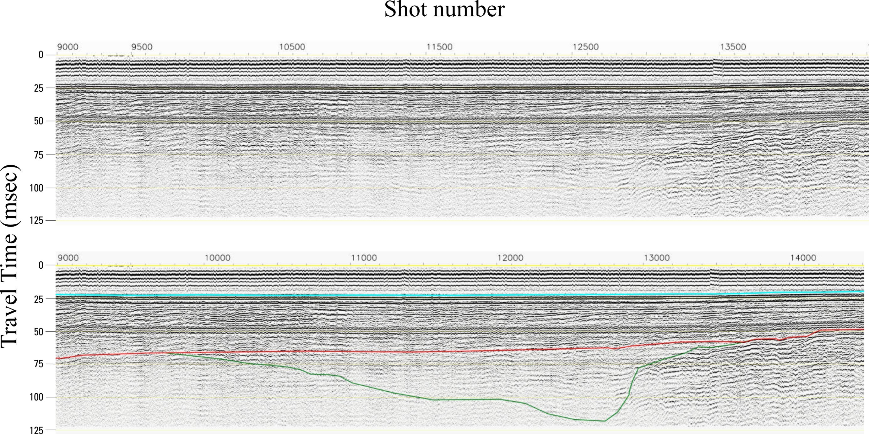
Home | Intro | Geology | Methods | Animation | Data | GIS | Acknowledgements | References | AppendixFigure 4. Uninterpreted (top) and interpreted (bottom) seismic profile on the continental shelf off the mouth of the Columbia River showing the three surfaces identified for this study. The lowstand surface is shown in green, the ravinement surface in red and the modern surface (the seafloor) in blue. Profile location shown in Figure 2. The entire profile can be viewed in the Data section or in the GIS that are included on the CD-ROM.