U. S. Geological Survey Open-File Report 01-154
|
|
|
U. S. Geological Survey Open-File Report 01-154 |
SEA-FLOOR PHOTOGRAPHY FROM THE CONTINENTAL MARGIN PROGRAM:A Pictorial Survey of Benthic Character and Habitats
|
|
Photographic Gallery of personnel, facilities and equipment from the Continental Margin Program |
|
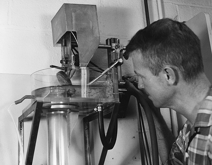
Dr. John S. Schlee, USGS, prepares to drop a sample of sand (adhered to the upended disc at center) into a long plexiglass tube in order to make a size analysis of the sand. The weight of the particles and the time it takes them to fall down the tube is measured by a transducer and recorded as a "size curve" on tape. This work is part of a joint WHOI-USGS study on the Atlantic Continental Shelf and Slope. |