Open–File Report 02–327
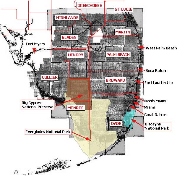
Uppercase text in boxes are county names: (Dade, Monroe, Broward, Collier, Palm Beach, Hendry, Martin, Glades, Highlands, St. Lucie and Okeechobee)
Text inside boxes are Federal Lands: (Biscayne National Park, Everglades National Park and Big Cypress National Preserve)
Text not contained in a box are city names: (Coral Gables, Miami, North Miami, Fort Lauderdale, Boca Raton, West Palm Beach and Fort Myers)

![]() U.S. Department of the Interior |
U.S. Geological Survey
U.S. Department of the Interior |
U.S. Geological Survey
URL: http://pubsdata.usgs.gov/pubs/of/2002/0327/location.html
Page Contact Information: GS Pubs Web Contact
Page Last Modified: Wednesday, 08-Jun-2022 15:42:08 EDT
