Open–File Report 02–327
1 USGS
2 DynCorp/DynTel, Gainesville, Florida 32601
3 University of Florida, 412 NE 16th Ave., Gainesville, Florida 32601
4 Eckerd College, 4200 54th Ave. South, St. Petersburg, Florida 33711
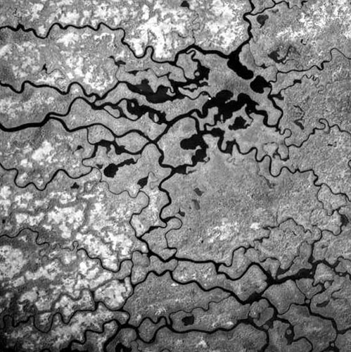
A maze of trees where lower Shark Slough meets mangroves near Whitewater Bay, Everglades National Park.
These 1940 aerial photographs are archived in this Open File Report.

![]() U.S. Department of the Interior |
U.S. Geological Survey
U.S. Department of the Interior |
U.S. Geological Survey
URL: http://pubsdata.usgs.gov/pubs/of/2002/0327/index.html
Page Contact Information: GS Pubs Web Contact
Page Last Modified: Wednesday, 08-Jun-2022 14:49:48 EDT
