Making USGS information effective in the electronic age, USGS Open-File Report 03-240
Title Page
Summary
Introduction
Goals
Overview
Outcome
Appendices
I. Agenda
II. Porter: Vision
III. Frodeman:
Earth Science
IV. McDermott/Wendt:
Communications
V. JOURNEAY:
CORDlink
ROLE
GEOLIBRARY
NHEMATIS
VI. Marincioni: MRIB
VII. Faust: CMGP
VIII. Brainstorming
IX. Participants
APPENDIX V - CORDlink
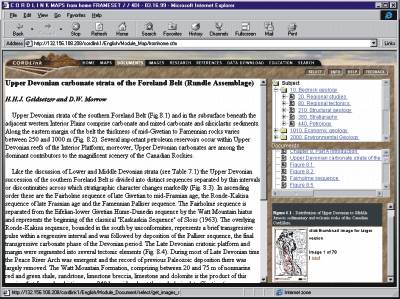
Presentation: Murray Journeay - The Example of CordLink
Role of GeoScience Knowledge GeoLibrary Project Nhematis
The CORDLink GeoLibrary Project
 |
Objectives
|
What is a Distributed Geolibrary
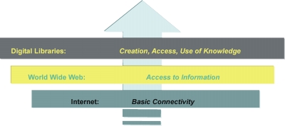 |
 | The Library Concept:Stewardship of shared information resources to promote both pure and applied research has traditionally been one of the principle roles of our library systems.Libraries are based on the premise of sharing information for mutual benefit. They exist to acquire, give access to and safeguard carriers of knowledge and information in all forms, and to provide instruction and assistance in the use of the collections to which the users have access. |
GeoLibraries:are built upon these same principles. They represent shared collections of geographically referenced information (maps, documents, multi-media) that are stored in a relational database and accessed through a suite of Web-based applications in a distributed network environment using standard (open) protocols. |
|
What we Know
 Data
|
 Information
|  Knowledge
|
How to communicate what we know in a digital realm
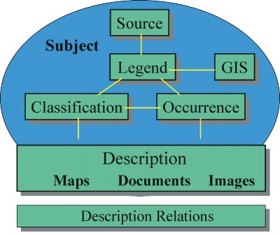
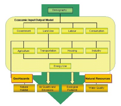
Data Models: Frameworks for managing and representing scientific concepts and relationships
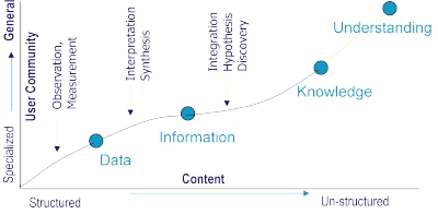
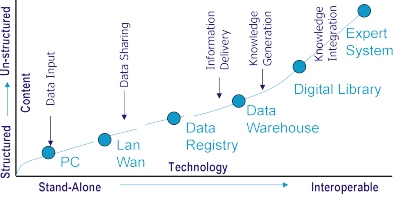
Distributed GeoLibrary Design Space
From Marchionini, G., and Fox, E.A., 1999, Progress toward digital libraries: IPM, v. 35, p. 219-225.
CommunityA region or group of people who share common ecological socio-economic, cultural, political and/or legal issues | 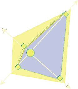 | TechnologyData modeling, warehousing, distributed networks, retrieval, interoperability | |
ServicesFunctionality, search, browse, providing replies to queries, mechanisms to encourage and simplify greater participation from users | ContentThe guts: data, observations, information, maps, images, texts, video, audio | ||
.
| Technology | |||
| Community | 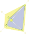 | ||
| Services | Content | ||
| Technology | |||
| Community | | ||
| Services | Content | ||
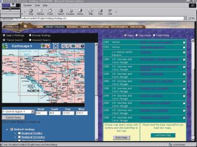
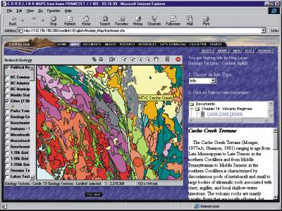
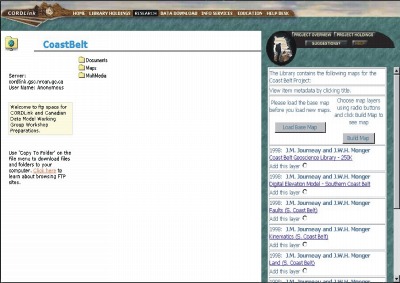
CORDLink GeoLibrary
Community
|  | Technology
| |
Services
| Content
| ||
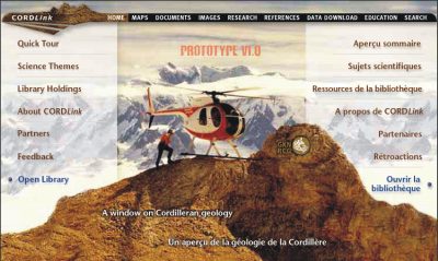
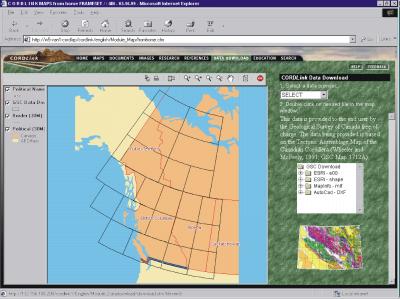
http://cordlink.gsc.nrcan.gc.ca/CORDLink
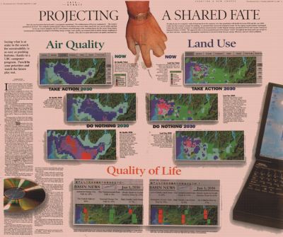
The Georgia Basin GeoLibrary:
A fundamental question driving current trends in sustainable development research is:
how can we enhance human well-being while protecting ecological health at the community level ?
To what extent, and in which ways can the Geoscience community contribute to a better understanding and balance of this equation?
The Georgia Basin Futures Project and the Georgia Basin Ecosystem Initiative have embarked on a multi- year study to address this question through:
- The alignment of key scientific research and knowledge generation initiatives across government and academic sectors,
- The development of public consultation mechanisms to support community-based learning and sustainability initiatives, and
- The integration of Web-based information and and decision support systems for managing these collective knowledge resources and for analyzing alternate scenarios by which sustainable conditions might be achieved in the Georgia Basin over the next four decades
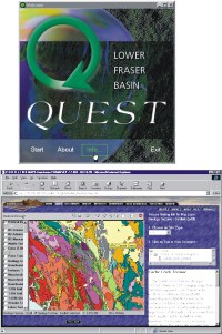
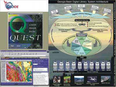
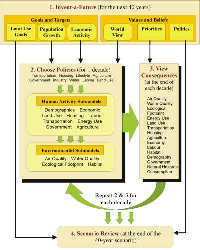
| Decision Support Systems:Using the Georgia Basin region as a pilot study, SDRI is in the process of expanding QUEST for use in a Web-based environment to foster scenario modeling and public consultation activities in support of both the Georgia Basin Futures Project and the Georgia Basin Ecosystem Initiative.Geolibrary System:CORDLink represents one of the first efforts in Canada to successfully build a digital library prototype for managing multi-variant science information and knowledge resources in a distributed network environment. |
The Opportunity:
Building a linkage between QUEST and digital library technologies provides an opportunity to develop operational procedures for better integrating natural science and socio-economic information for purposes of sustainability modeling and land-use planning.
Objectives:
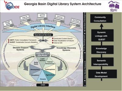
Develop the necessary conceptual framework for a Web-based digital library that will seamlessly integrate natural and social science information (GIS maps, images, and text) into a comprehensive information resource to support sustainability research, community-focused decision making and public consultation activities in the Georgia Basin region of western Canada.
 |  |
 |