Making USGS information effective in the electronic age, USGS Open-File Report 03-240
Title Page
Summary
Introduction
Goals
Overview
Outcome
Appendices
I. Agenda
II. Porter: Vision
III. Frodeman:
Earth Science
IV. McDermott/Wendt:
Communications
V. JOURNEAY: CORDlink
ROLE
GEOLIBRARY
NHEMATIS
VI. Marincioni: MRIB
VII. Faust: CMGP
VIII. Brainstorming
IX. Participants
APPENDIX V - CORDlink
Presentation: Murray Journeay - The Example of CordLink
Role of GeoScience Knowledge GeoLibrary Project Nhematis
Nhematis for Natural Hazards Planning and Assessment | |
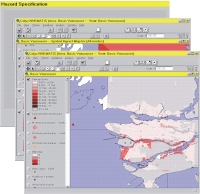 | To conduct its analyses, NHEMATIS uses the following technologies and data:
|
Our World - Science World
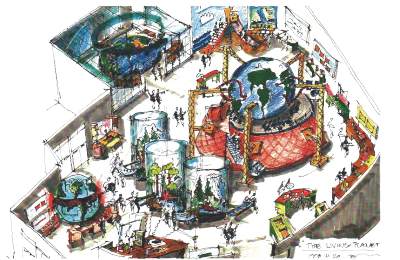
Communications Opportunity for Natural Resources Canada
Science World - "Our World" exhibit
| ExploRover: Travelling through the west coast, first stop: natural hazards of the northern Cascadia forrearc | 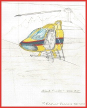 |
| Murray Journeay, Sonia Talwar & Rob Harrap | |
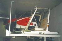
ExploRover - a helicopter, submersisble and earth mole transformer | |
 | The Experience: Users enter the ExploRover and receive Earth observation transmissions from the mothership. The first of several missions is to explore geohazards in the forearc & the potential societal impact of these events. |
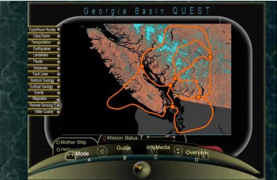
While cruising over the Strait of Georgia, the user decides to take the plunge. S/he switches the device into submersible mode, splashes into the water and with X-Ray mode on, peels back the surface to explore three different types of earthquakes: subduction zone, interplate, and shallow crustal. Locations of earthquakes and images and/or newspaper articles describing the event are presented.. [Mechanisms to rattle and shake the ExploRover to simulate earthquake are being explored.] | |
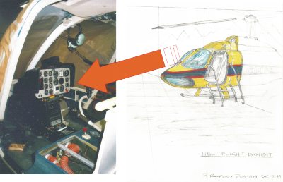 | |
| Using a computer screen mounted within the instrument panel and a computer joystick located between the seats, the user accepts his/her mission and proceeds to fly over the Georgia Basin. | |
| |
