Link to USGS home page Link to USGS home page
Coastal and Marine Geology Program
Coastal & Marine Geology Program > Coastal Classification Mapping Project > Open File Report 03-322

Coastal Classification Atlas

Southwestern Florida Coastal Classification Maps - Venice Inlet to Cape Romano

USGS Open File Report 03-322

Robert A. Morton, Russell L. Peterson

Report Home Maps Overview Mapping Methods Coastal Classifications Geologic Setting Coastal Processes Coastal Vulnerability Classification Summary References
Introduction || City: Venice | Englewood | Placida | Port Boca Grande | Bokeelia | Captiva | Wulfert | Sanibel | Fort Myers Beach | Estero | Bonita Springs | Naples | Marco Island | Cape Romano
Area: Port Boca Grande Southeast/Bokeelia Southwest

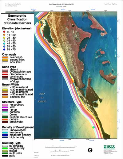
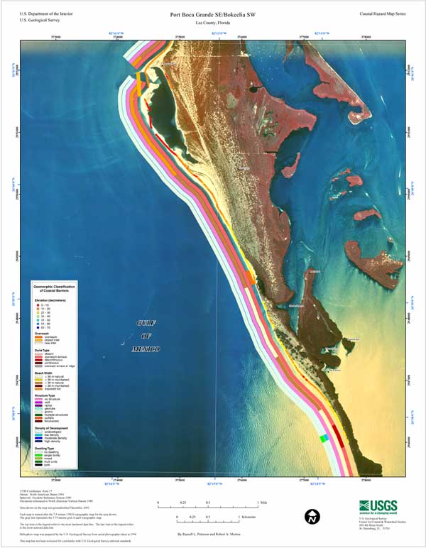
Port Boca Grande SE/Bokeelia SW Coastal Classification Map

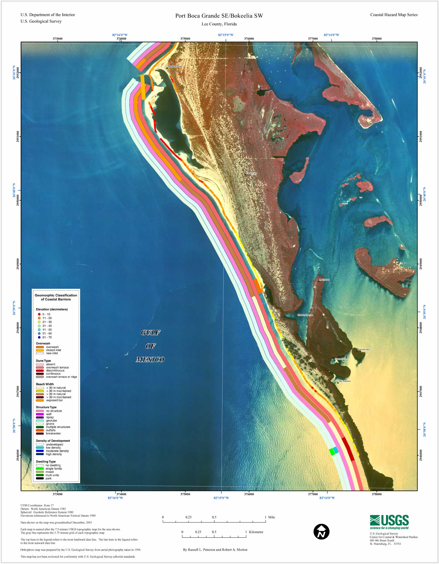
Coastal Classification Map for Port Boca Grande SE/Bokeelia SW. Map showing the coastal classifications along the Port Boca Grande SE/Bokeelia SW shoreline. The top item in the legend refers to the most landward data line. The last item in the legend refers to the most seaward data line. Click on the links below to download and view larger versions of the map.

8 1/2" X 11" (54 KB JPEG)
14" X 18" (137 KB JPEG)
21" X 27" (286 KB JPEG)
  Printable PDF version (12 M PDF)
Can't see the PDF version?
Get Adobe Acrobat® Reader

Coastal Classification Map for Port Boca Grande SE/Bokeelia SW   index map, Port Boca Grande SE/Bokeelia SW selected
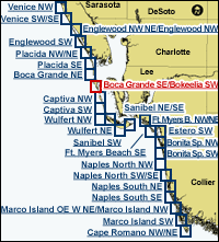
Clickable Index Map. Use the index map above to navigate to the different coastal areas. The selected area is outlined in red.

Port Boca Grande NECape Romano NEMarco Island SWMarco Island OE W Ne/Marco Island NWNaples South SENaples South NENaples North SWNaples North NWBonita Springs SWBonita Springs NWFort Myers Beach SEFort Myers Beach SEEstero SWFort Myers Beach NW/NESanibel NE/SESanibel SWSanibel SWWulfert NEWulfert NEWulfert NWSanibel NE/SECaptiva SWCaptiva NWPlacida SEPlacida NW/NEEnglewood SWEnglewood NW NE/Englewood SWVenice SW/SEVenice NW

Coastal & Marine Geology Program > Coastal Classification Mapping Project > Open File Report 03-322


[an error occurred while processing this directive]