Link to USGS home page Link to USGS home page
Coastal and Marine Geology Program
Coastal & Marine Geology Program > Coastal Classification Mapping Project > Open File Report 03-322

Coastal Classification Atlas

Southwestern Florida Coastal Classification Maps - Venice Inlet to Cape Romano

USGS Open File Report 03-322

Robert A. Morton, Russell L. Peterson

Report Home Maps Overview Mapping Methods Coastal Classifications Geologic Setting Coastal Processes Coastal Vulnerability Classification Summary References
Introduction || City: Venice | Englewood | Placida | Port Boca Grande | Bokeelia | Captiva | Wulfert | Sanibel | Fort Myers Beach | Estero | Bonita Springs | Naples | Marco Island | Cape Romano
Area: OE West Northeast/Marco Island Northwest | Southwest

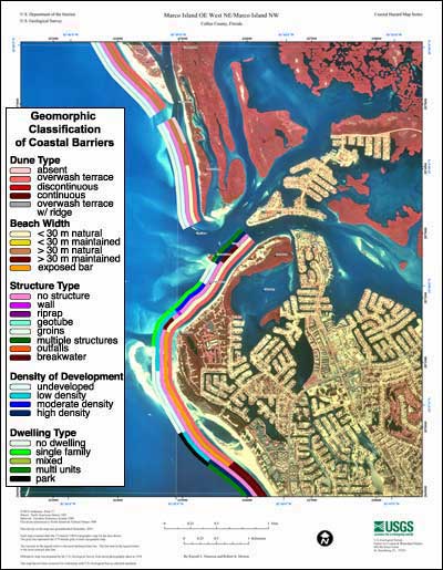
Marco Island OE W NE/Marco Island NW Coastal Classification Map

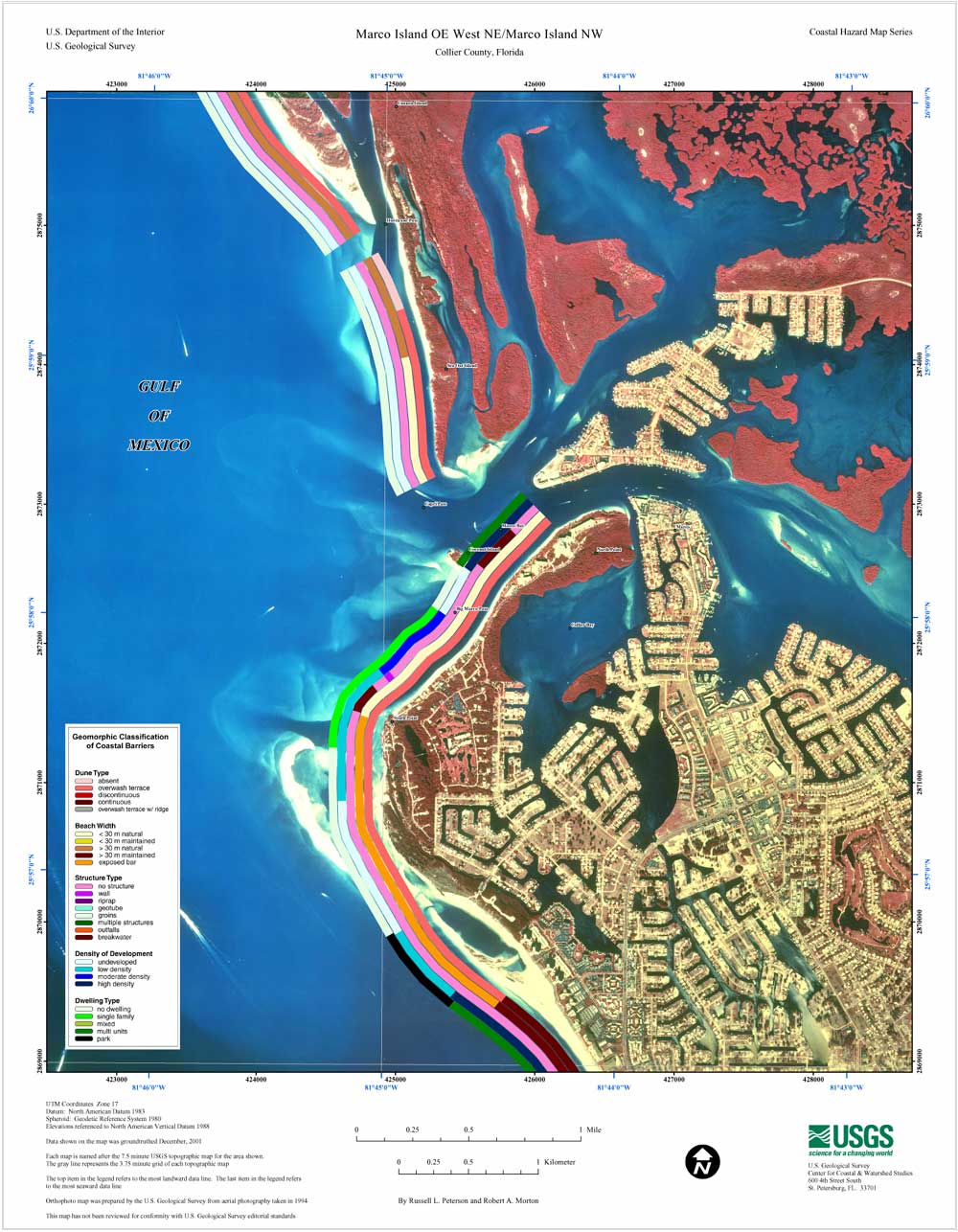
Coastal Classification Map for Marco Island OE W NE/Marco Island NW. Map showing the coastal classifications along the Marco Island OE W NE/Marco Island NW shoreline. The top item in the legend refers to the most landward data line. The last item in the legend refers to the most seaward data line. Click on the links below to download and view larger versions of the map. ("OE" is a map naming convention that stands for "Over Edge" meaning the quad for an area does not have a USGS quad number because the data is included on the adjoining map sheet.)

8 1/2" X 11" (76 KB JPEG)
14" X 18" (187 KB JPEG)
21" X 27" (381 KB JPEG)
  Printable PDF version (11.3 M PDF)
Can't see the PDF version?
Get Adobe Acrobat® Reader

Coastal Classification Map for Marco Island OE W NE/Marco Island NW   index map, Marco Island OE W NE selected
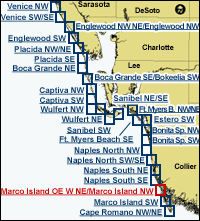
Clickable Index Map. Use the index map above to navigate to the different coastal areas. The selected area is outlined in red.

Estero SWEnglewood NW NE/Englewood NWCaptiva SWCaptiva NWPort Boca Grande SE/Bokeelia SWPort Boca Grande NECape Romano NEMarco Island SWNaples South SENaples South NENaples North SWNaples North NWBonita Springs SWBonita Springs NWFort Myers Beach SEFort Myers Beach SEFort Myers Beach NW/NESanibel NE/SESanibel SWSanibel SWWulfert NEWulfert NEWulfert NWSanibel NE/SEPlacida SEPlacida NW/NEEnglewood SWVenice SW/SEVenice NW

Coastal & Marine Geology Program > Coastal Classification Mapping Project > Open File Report 03-322


[an error occurred while processing this directive]