|
 |
|
|
 |
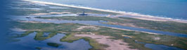
| Physical Agents of Land Loss: |
|
| Waves, Currents, & Storm Surges |
 |
|
|
|
|
|
|
|
|
 |
|
|
|
|
|
| Role of Shoreline Characteristics: |
|
|
|
|
|
|
|
|
|
|
| Role of Human Activities: |
|
|
|
|
|
|
|
|
|
|
|
|
|
|
|
|
|
|
|
|
|
|
|
|
|
|
Physical Agents of Land Loss: Waves, Currents, & Storm Surges
El Niño Events
Along the Pacific coast, winter storms and unusual oceanographic conditions such as El Niño cause the most beach erosion and land loss. Compared to other storm systems, El Niño is an infrequent, but significant event that has a profound effect on weather patterns, ocean currents, and fluctuations in sea level. About every 4 to 5 years, El Niño conditions cause warm surface water of the Pacific Ocean to flow eastward piling up water along the west coast of North and South America (Philander, 1989). The elevated water levels coupled with unusually strong storms during El Niño events cause extensive flooding and erosion of West Coast beaches (Komar and Enfield, 1987). In the spring of 1983, an unusually strong El Niño caused torrential rainfall, rapid beach erosion, and massive landslides along the Pacific coast of the United States. Land loss was concentrated along the southern California coast where numerous expensive homes built on unconsolidated bluffs were damaged or destroyed.
continue to Landslides & Cliff Retreat
|