|
 |
|
|
 |
| Physical Agents of Land Loss: |
|
|
|
|
|
|
|
| Relative Sea Level |
 |
|
|
 |
|
|
|
|
|
| Role of Shoreline Characteristics: |
|
|
|
|
|
|
|
|
|
|
| Role of Human Activities: |
|
|
|
|
|
|
|
|
|
|
|
|
|
|
|
|
|
|
|
|
|
|
|
|
|
|
Physical Agents of Land Loss: Relative Sea Level
Effects of Submergence
 |
| Figure 8. More than 200 homes were inundated and destroyed in the Brownwood subdivision of Baytown, Texas after the ground subsided as much as 3 m. [larger version] |
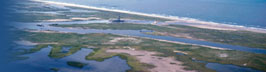
Regardless of its cause, coastal submergence contributes to land loss in several ways. The most easily recognized effects of submergence are land losses caused by permanent flooding. The passive inundation of the shore typically expands estuaries, lakes, and lagoons at the expense of adjacent uplands and wetlands. The slope of the land surface and rate of sea level rise control the extent of permanent flooding. Steep slopes and low rates of sea-level rise produce negligible flooding, whereas low slopes and rapid rates of sea-level rise inundate such vast areas so rapidly that the submergence can be detected in a few decades. Rapid coastal submergence has been documented at Baytown, Texas (Fig. 8) near Houston and on the Mississippi Delta. Subsiding land areas experience greater and more prolonged flooding by salt water associated with storms. This means that storm surges of historical record would inundate larger areas if similar storms were to occur today. Eventually the repeated inundation by saltwater expands the flood zones and alters the predominant wetland plant assemblages. This occurs because salinities within the wetlands and estuaries increase, as they are permanently flooded. In many coastal regions the inundation of salt water actually accelerates wetland losses because both fresh-water and salt-water marshes are destroyed faster than new wetlands are created. The intolerant fresh-water marshes are killed by salt-water, whereas the salt-water marshes are drowned and converted to open water.
Submergence also accelerates coastal erosion because it facilitates greater inland penetration of storm waves. An example is retreat of the bluffs at Calvert, Maryland on the Chesapeake Bay. As a result of submergence, some bluffs that were not previously reached by storm waves are subjected to erosion. In addition to accelerated land loss, coastal submergence causes intrusion of salt-water into coastal aquifers and into the rivers that empty into the estuaries. Submergence also changes surface drainage patterns, raises groundwater levels, and causes areas even above sea level to pond water and to be poorly drained. Around Pamlico Sound, North Carolina, dead trees are an indication of rising freshwater levels caused by the relative rise in sea level.
continue to Climate & Land Loss
|