U.S. Geological Survey Open-File Report 2004-1003
Sidescan Sonar Imagery and
Surficial Geologic Interpretation of the Sea Floor off Branford, Connecticut
|
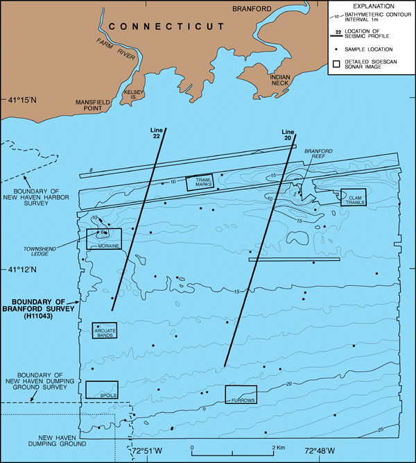
Bathymetric map of the Branford, Connecticut study area. Depths are in meters and are adjusted to mean lower low water. Locations of seismic-reflection profiles 20 and 22, sample stations, and detailed images of the sidescan sonar mosaic presented elsewhere in this report are indicated. To view the detailed sidescan sonar images, select the desired area from the map above. |