U.S. Geological Survey Open-File Report 2004-1003
Sidescan Sonar Imagery and
Surficial Geologic Interpretation of the Sea Floor off Branford, Connecticut
|
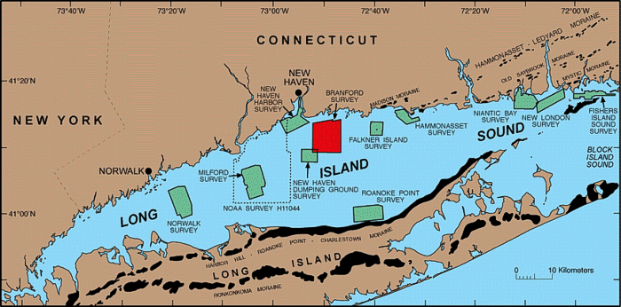
Map showing location of the Branford, Connecticut study area (red polygon). Also shown are major onshore moraines, and the sites of other interpreted sidescan sonar surveys in Long Island Sound: Norwalk -- Twichell and others (1997); Milford -- Twichell and others (1998); New Haven Harbor and New Haven Dumping Grounds -- Poppe and others (2001); Roanoke Point -- Poppe and others (1999a); Falkner Island -- Poppe and others (1999b); Hammonasset -- Poppe and others (1997); Niantic Bay -- Poppe and others (1998a); New London -- Poppe and others (1992), Moffett and others (1994), Zajac and others (2000, 2003); Fishers Island Sound -- Poppe and others (1998b). NOAA sidescan sonar survey H11044, shown by a dashed line, has not yet been interpreted. |