Introduction to the
Mojave National Preserve
General Mojave
Geologic History
Changing Climates
& Ancient Lakes
Desert Landforms and Surface Processes
in the Mojave National Preserve and Vicinity
Introduction
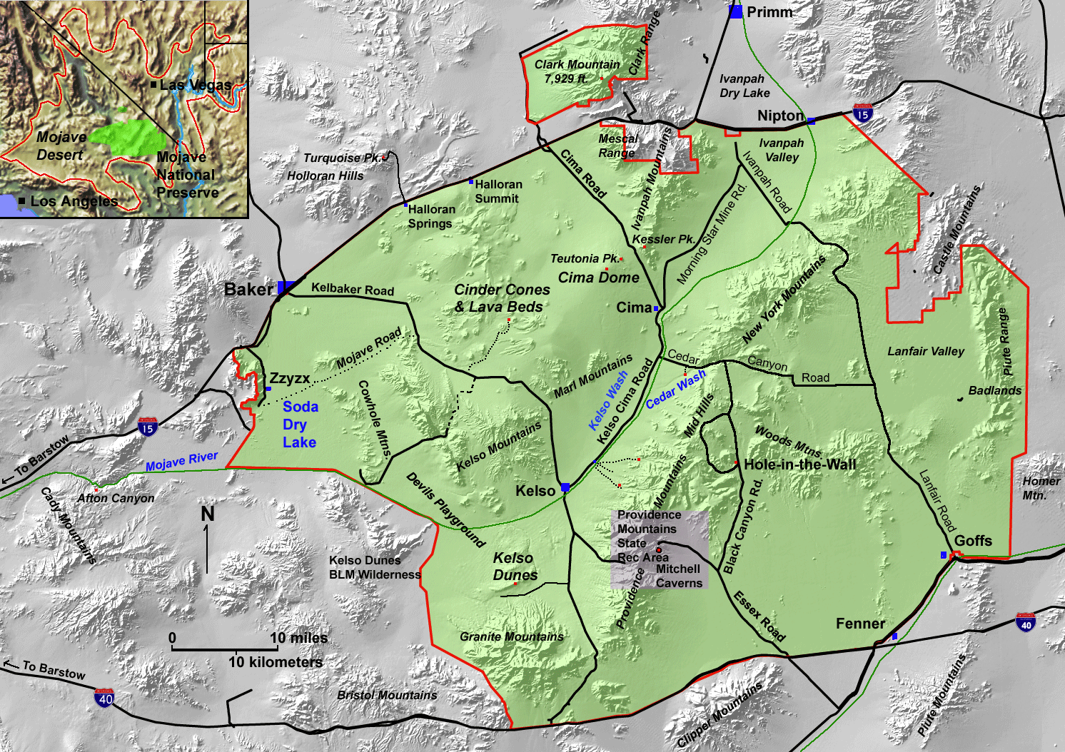
Several hundred thousand people travel along Interstate 15 between Los Angeles and Las Vegas every week, but typically less than one percent of these travelers venture off the main highway to spend time to view the desert scenery and to ponder its origin. However, even a brief stop will enchant visitors with the remarkable desert landscape. This website is intended to provide basic geologic information about the origin of landscape features throughout the Mojave National Preserve and surrounding region. The map below (Fig. 1) provides location reference to many of the landscape features referred to in discussions.
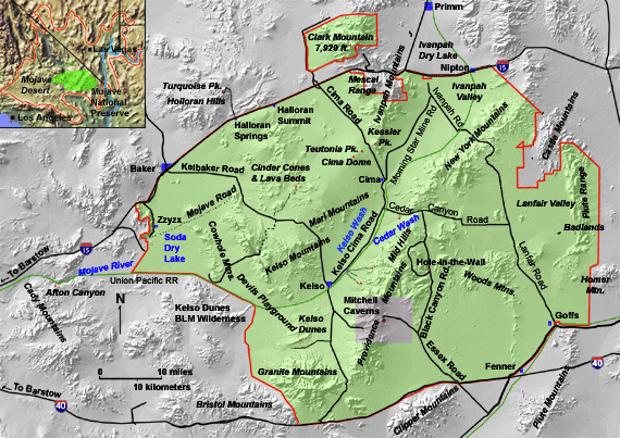 |
| Figure 1. Map showing the Mojave National Preserve and surrounding region. View a larger version of this map. |
Many natural factors and processes are responsible for the development of landforms in desert environments, particularly bedrock characteristics, and current and past climatic conditions and their changing plant communities. The landscape reflects the cumulative effects of geologic forces or events that have transpired over many millions of years. However, faulting, volcanism and erosion within the past million years, and particularly changing climatic conditions within the last 20,000 years, have had particularly strong effects on the physical appearance of the Mojave Desert landscape today.
This website provides basic discussions about the interplay of climatic factors with geologic characteristics and history of the Mojave Desert region primarily focusing on the Mojave National Preserve. Follow the discussion (like a book) by clicking on the "Continue to" links at the bottom of each page, or go directly to the selected sections by clicking any of the topical links on the left side of each page. Understanding regional climate history, physiography, and the physical characteristics and processes affecting earth materials are fundamental to interpreting the ongoing development of the Mojave Desert landscape and the ecosystem it supports. Follow the links to learn more about the physical environment of the Mojave National Preserve and surrounding region!
 |
To see a 3-D image tour of the Mojave National Preserve, click here. You will need red-and-cyan view glasses. Most of the photographs within this website appear in 3D on this on-line geology tour at http://3dparks.wr.usgs.gov/moja/. |

