The Gulf of the Farallones: Sidescan-Sonar Imagery,
USGS
Open-File Report 2004-1082
Home Page
/
Mosaic & Explanation
/
GIS
Data
/
Contacts
/
About this Disk
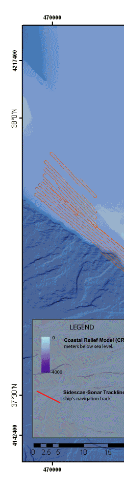
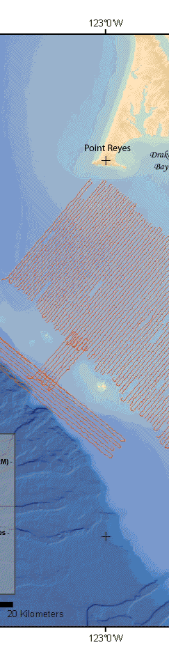
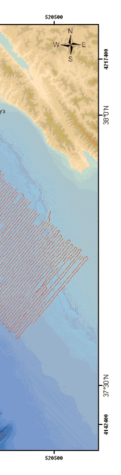
Figure 4.
Map showing the location of sidescan-sonar tracklines.
Back to Methods
[an error occurred while processing this directive]