Skip past header information
Identifier symbol and link to USGS Home page
The Gulf of the Farallones: Sidescan-Sonar Imagery, USGS Open-File Report 2004-1082

Skip past contents
Home Page / Mosaic & Explanation / GIS Data / Contacts / About this Disk

Three-dimensional image showing sidescan-sonar and coastal relief images of the Gulf of the Farallones. Three-dimensional image showing sidescan-sonar and coastal relief images of the Gulf of the Farallones. Three-dimensional image showing sidescan-sonar and coastal relief images of the Gulf of the Farallones. Three-dimensional image showing sidescan-sonar and coastal relief images of the Gulf of the Farallones. Three-dimensional image showing sidescan-sonar and coastal relief images of the Gulf of the Farallones. Three-dimensional image showing sidescan-sonar and coastal relief images of the Gulf of the Farallones.


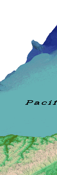
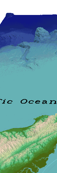
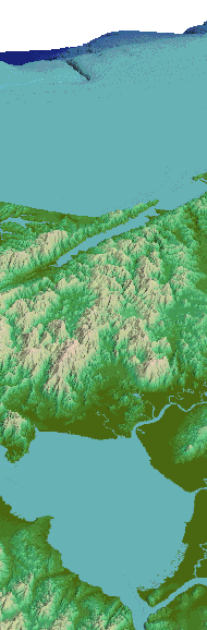
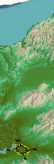
Figure 7. Three-dimensional view of the sidescan-sonar and coastal relief image in the Gulf of the Farallones. Elevation range: -3800 (dark blue) - +1450 (light brown).

Back GIS Data - 3D Views [an error occurred while processing this directive]