Barren Zone
An area of fresh, vegetation-free bedrock around the margin
of a retreating glacier that documents the recent loss of
ice.
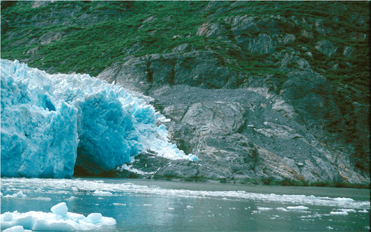
South-looking photograph showing a recently exposed
bare bedrock barren zone on the south margin of
South Sawyer Glacier in July 2001, Tongass National
Forest, Coast Mountains, Alaska. Note the subglacial
stream tunnel adjacent to the glacier margin. |
|
|
Bergschrund
A single large crevasse or series of sub-parallel crevasses
that develop at the head of a glacier. The location where
ice pulls away from the bedrock wall of the cirque against
which it accumulated. In winter, the crevasse fills with snow.
In spring or summer, it reopens. (Originally a German term)
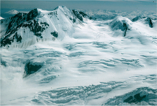
Northwest-looking oblique aerial photograph showing
a bergschrund composed of several nested series
of crevasses, located in the higher elevation
accumulation area of the Fairweather Range, west
of Mount Fairweather, Glacier Bay National Park,
Alaska. The mid-ground field of view is ~ 1.5
miles wide. |
|
|
Bergy Seltzer
A crackling or sizzling similar to that made by soft drinks or
seltzer water but louder. The sound made
as air bubbles formed at many atmospheres of pressure are
released during the melting of glacier ice. Also called
Ice Sizzle.

Northwest-looking photograph showing a part of
the calving terminus of Holgate Glacier, Kenai
mountains, Kenai Fiords National Park, Alaska,
with a dense concentration of 'brash ice' floating
in front of the terminus. This melting releases
air bubbles that cause bergy seltzer. |
|
|
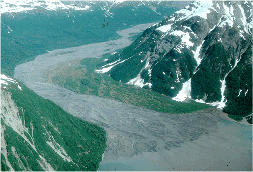
Southeast-looking oblique aerial photograph showing
an unnamed, meandering braided stream and delta.
Individual stream channels have been filled by glacial
meltwater high in rock flour from Hidden Glacier.
Russell Fiord Geological Wilderness, St. Elias Mountains,
Tongass National Forest, Alaska. |
Braided Stream (Anastomizing Stream)
A stream that is characterized by a complex network of branches
that continuously separate and reunite. Streams braid when
they have a much greater sediment load than they can carry.
Also called an Anastomosing Stream.
|
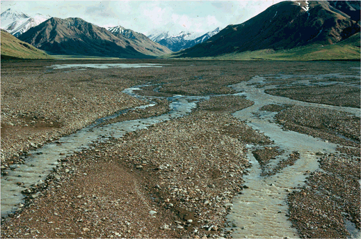
South-looking photograph showing diamond-shaped
bars and meandering braided stream channels, East
Fork Toklat River, Alaska Range, Denali National
Park, Alaska. |
|
|
|